
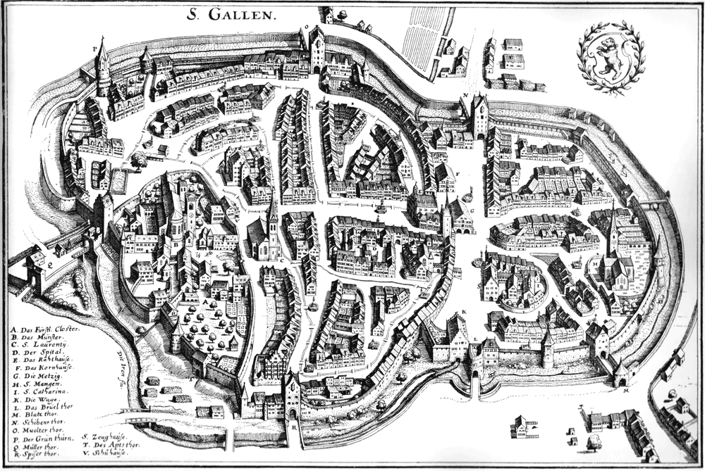
Image: Stadtplan St Gallen 1642
Size of this preview: 800 × 535 pixels. Other resolutions: 320 × 214 pixels | 1,000 × 669 pixels.
Original image (1,000 × 669 pixels, file size: 224 KB, MIME type: image/png)
Description: The City of St. Gallen 1642
Title: Stadtplan St Gallen 1642
Credit: Topographia Helvetiae, Rhaetiae, et Valesiae. Das ist/ Beschreibung unnd eygentliche Abbildung der vornehmsten Stätte und Plätze in der Hochlöblichen Eydgenossschafft / Graubündten / Wallis / und etlicher zugewandten Orthen: In dieser andern Edition mit sonderm fleiß durchgangen/ und von virgen Fehlern corrigirt / vermehrt und gebessert. Franckfurt am Mayn 1654.
Author: Matthäus Merian, upload by sidonius 14:26, 19 December 2006 (UTC)
Permission: old
Usage Terms: Public domain
License: Public domain
Attribution Required?: No
Image usage
The following page links to this image:

All content from Kiddle encyclopedia articles (including the article images and facts) can be freely used under Attribution-ShareAlike license, unless stated otherwise.