
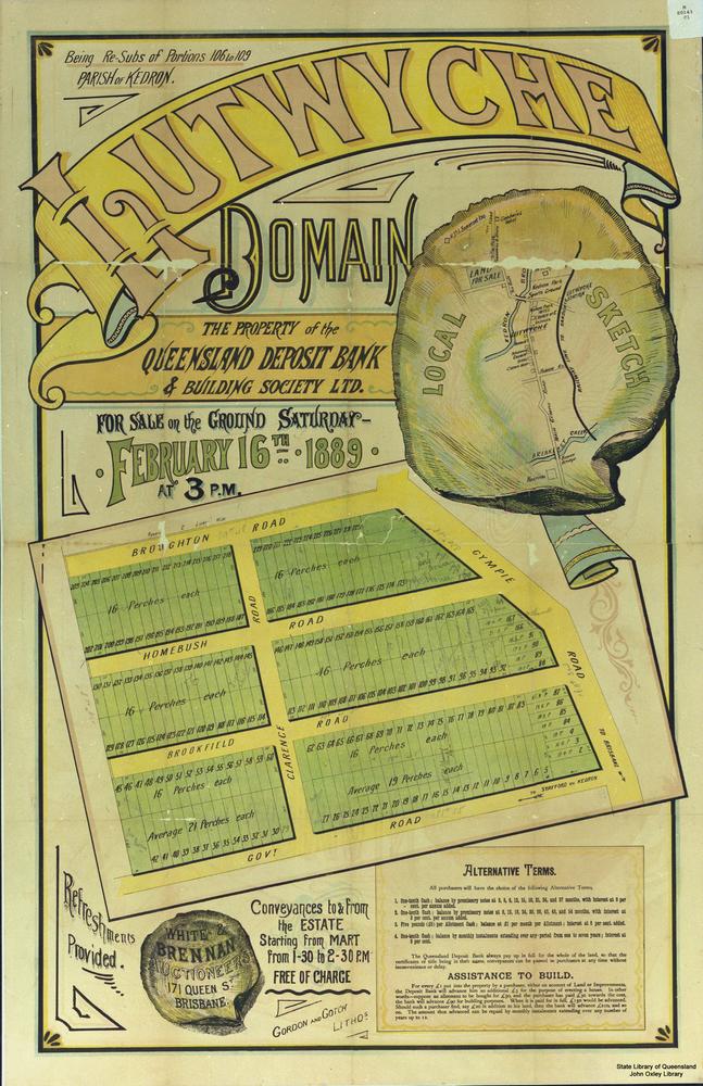
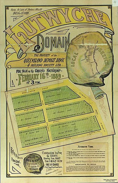
Image: StateLibQld 1 131179 Estate map for Lutwyche Domain, Brisbane, Queensland, 1889
Size of this preview: 388 × 600 pixels. Other resolutions: 155 × 240 pixels | 647 × 1,000 pixels.
Original image (647 × 1,000 pixels, file size: 146 KB, MIME type: image/jpeg)
Description: Estate map for Lutwyche Domain, Brisbane, Queensland, 1889 Lutwyche Domain Estate map for a land auction showing a plan of allotments to be sold on the 16th February, 1889 by White & Brennan, Auctioneers, 171 Queen Street, Brisbane, Queensland. The sale of land allotments covers the areas between Gympie Road, Clarence Road, Broughton Road, Homebush Road, Brookfied Road and Government Road (later known as Stafford Road), Brisbane.
Title: StateLibQld 1 131179 Estate map for Lutwyche Domain, Brisbane, Queensland, 1889
Credit: Copied and digitised from the original map in the John Oxley Library ME 0143, 1889
Usage Terms: Public domain
License: Public domain
Attribution Required?: No
Image usage
The following page links to this image:

All content from Kiddle encyclopedia articles (including the article images and facts) can be freely used under Attribution-ShareAlike license, unless stated otherwise.