
Image: StateLibQld 1 189011 Aerial view of New Farm showing New Farm Park, ca. 1925
Size of this preview: 738 × 600 pixels. Other resolutions: 295 × 240 pixels | 1,000 × 813 pixels.
Original image (1,000 × 813 pixels, file size: 126 KB, MIME type: image/jpeg)
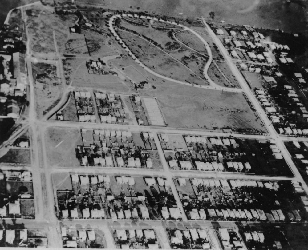
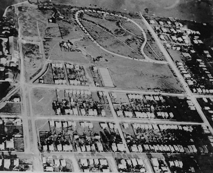
Description: Aerial view of New Farm showing New Farm Park, ca. 1925. This aerial view of New Farm shows New Farm Park in centre, with the circular road way . A small area of the Brisbane River can be seen next to the park (top of photograph). On the right of the park is Brunswick Street. The track-like street on the far left is James Street. Sydney Street runs across the photograph and forms the third border of the park. Residential housing is shown.
Title: StateLibQld 1 189011 Aerial view of New Farm showing New Farm Park, ca. 1925
Credit: Item is held by John Oxley Library, State Library of Queensland.
Usage Terms: Public domain
License: Public domain
Attribution Required?: No
Image usage
The following page links to this image:

All content from Kiddle encyclopedia articles (including the article images and facts) can be freely used under Attribution-ShareAlike license, unless stated otherwise.