
Image: Stewart Island map-en

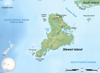
Description: English: Map of Stewart Island / Rakiura, New Zealand. Altitude levels: 50 m, 125, 250, 500, etc. (same for bathymetry). Projection: New Zealand Geodetic Datum 2000 ; GRS80 datum. Standard meridian: 167°45' E True scale parallel: 47° S Geographic limits of the map: West: 166.75 E East: 168.75 E North: 46.5 S South: 47.5 S
Title: Stewart Island map-en
Credit: English: Shorelines: NASA Shuttle Radar Topography Mission (SWBD) (public domain) ; Topography: NASA Shuttle Radar Topography Mission (SRTM3 v.2) (public domain) ; Bathymetry: NGDC ETOPO1 (public domain) ; NZL orthographic NaturalEarth.svg by Gringer under licence Public Domain ; New Zealand location map.svg by NordNordWest under licence GFDL or CC-BY-SA 3.0
Author: Sémhur (talk)
Usage Terms: Free Art License
License: FAL
License Link: http://artlibre.org/licence/lal/en
Attribution Required?: Yes
Image usage
The following page links to this image:
