
Image: Stirlingshire map 2
No higher resolution available.
Stirlingshire_map_2.png (431 × 309 pixels, file size: 10 KB, MIME type: image/png)
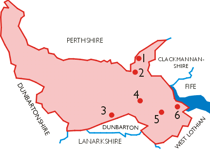
Description: Map of the County of Stirlingshire c 1975, showing the position of the six burghs in the county.
Title: Stirlingshire map 2
Credit: Transferred from en.wikipedia to Commons.
Author: Lozleader at English Wikipedia
Usage Terms: Creative Commons Attribution-Share Alike 3.0
License: CC BY-SA 3.0
License Link: http://creativecommons.org/licenses/by-sa/3.0/
Attribution Required?: Yes
Image usage
The following page links to this image:

All content from Kiddle encyclopedia articles (including the article images and facts) can be freely used under Attribution-ShareAlike license, unless stated otherwise.