
Image: Stlouistreatymap1804

Size of this preview: 470 × 600 pixels. Other resolutions: 188 × 240 pixels | 1,000 × 1,276 pixels.
Original image (1,000 × 1,276 pixels, file size: 312 KB, MIME type: image/png)
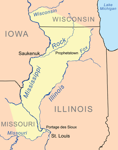
Description: Map showing lands ceded in the 1804 Treaty of St. Louis in yellow.
Title: Stlouistreatymap1804
Credit: Own work, background features are from the National Atlas. Cession border is based on treaty text with Library of Congress maps used as reference.
Author: Kmusser
Usage Terms: Creative Commons Attribution-Share Alike 3.0
License: CC BY-SA 3.0
License Link: http://creativecommons.org/licenses/by-sa/3.0
Attribution Required?: Yes
Image usage
The following 2 pages link to this image:

All content from Kiddle encyclopedia articles (including the article images and facts) can be freely used under Attribution-ShareAlike license, unless stated otherwise.