
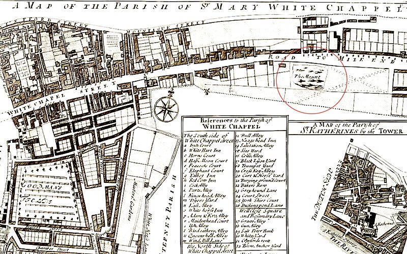
Image: Strype, map of Whitechapel, 1720

Size of this preview: 800 × 500 pixels. Other resolutions: 320 × 200 pixels | 2,560 × 1,600 pixels.
Original image (2,560 × 1,600 pixels, file size: 1.52 MB, MIME type: image/jpeg)
Description: 'A map of the parish of St Mary White Chappel' in John Strype's 'A survey of the Cities of London and Westminster', 1720 (crop)
Title: Strype, map of Whitechapel, 1720
Credit: https://www.dhi.ac.uk/strype/figures.jsp
Author: John Strype
Usage Terms: Public domain
License: Public domain
Attribution Required?: No
Image usage
The following page links to this image:

All content from Kiddle encyclopedia articles (including the article images and facts) can be freely used under Attribution-ShareAlike license, unless stated otherwise.