
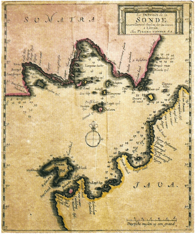
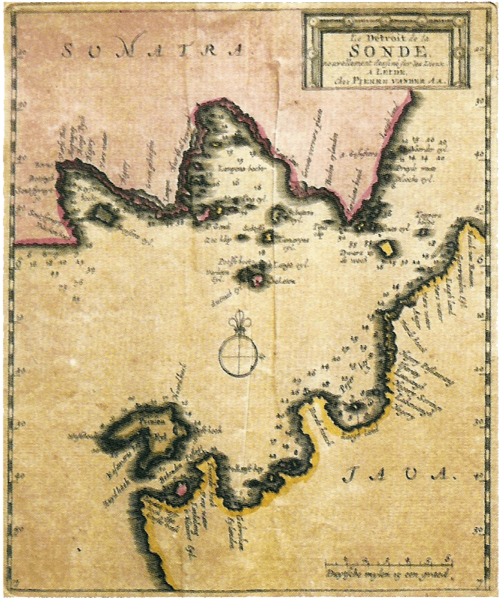
Image: Sunda Strait Map
Size of this preview: 503 × 600 pixels. Other resolutions: 201 × 240 pixels | 669 × 798 pixels.
Original image (669 × 798 pixels, file size: 1.34 MB, MIME type: image/png)
Description: A map created by Pierre (Pieter) Van der Aa in 1729, showing the Sunda Strait. The depth is marked by different colours.
Title: Sunda Strait Map
Credit: Museum Nasional: 1778 - 2008 National Museum of Indonesia. 2008. P 38
Author: Pierre (Pieter) Van Der Aa
Usage Terms: Public domain
License: Public domain
Attribution Required?: No
Image usage
The following page links to this image:

All content from Kiddle encyclopedia articles (including the article images and facts) can be freely used under Attribution-ShareAlike license, unless stated otherwise.