
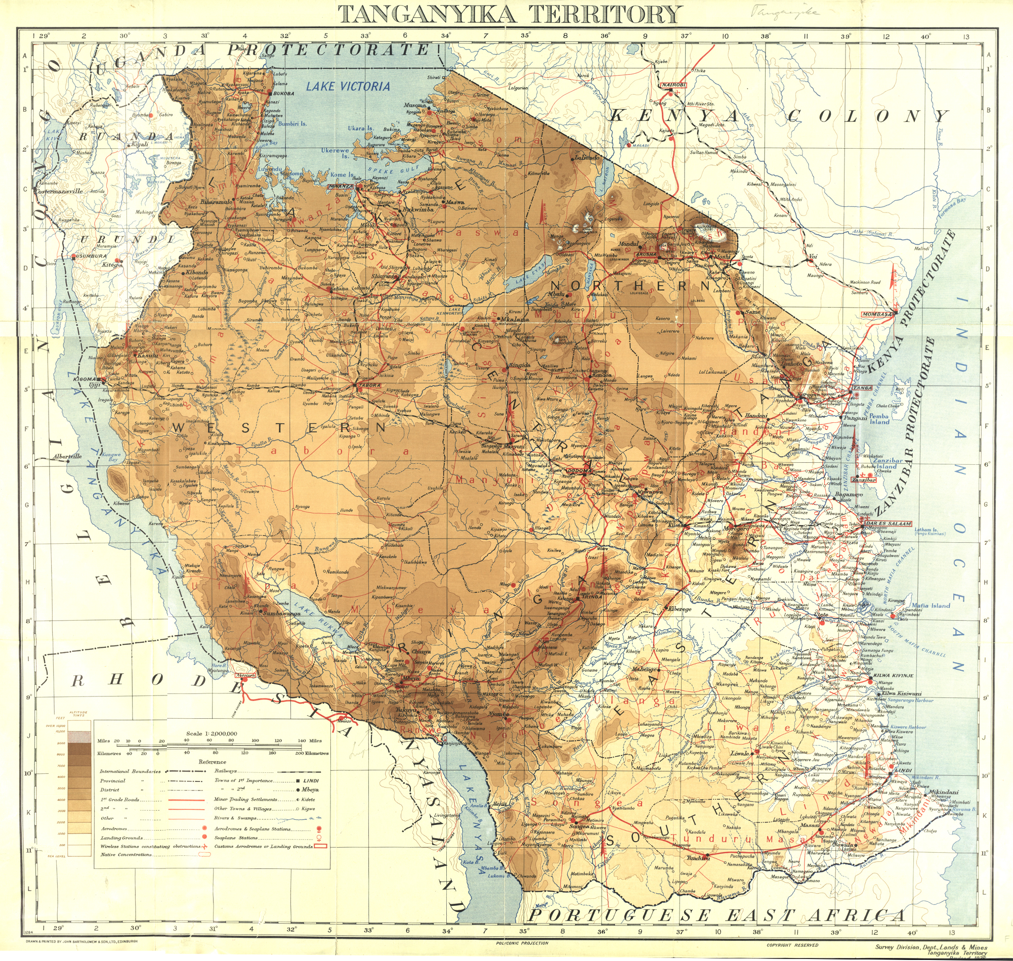
Image: Tanganyika F13
Size of this preview: 632 × 600 pixels. Other resolutions: 253 × 240 pixels | 2,002 × 1,900 pixels.
Original image (2,002 × 1,900 pixels, file size: 4.53 MB, MIME type: image/jpeg)
Description: Tanganyika Territory F13 by Survey division, dept. lands and mines Tanganyika territory (year: 1926 or 1936, not visible on original map). NOTE: This is the 1936 revision of the 1933/1934 1:2m production, sent from Dar for publication in Scotland. See CO 1047/169 at UK National Archives.
Title: Tanganyika F13
Credit: African Studies Centre Leiden
Author: Survey division, dept. lands and mines Tanganyika territory
Usage Terms: Public domain
License: Public domain
Attribution Required?: No
Image usage
The following 2 pages link to this image:

All content from Kiddle encyclopedia articles (including the article images and facts) can be freely used under Attribution-ShareAlike license, unless stated otherwise.