
Image: Tarimrivermap

Size of this preview: 800 × 543 pixels. Other resolutions: 320 × 217 pixels | 1,449 × 983 pixels.
Original image (1,449 × 983 pixels, file size: 2.09 MB, MIME type: image/png)
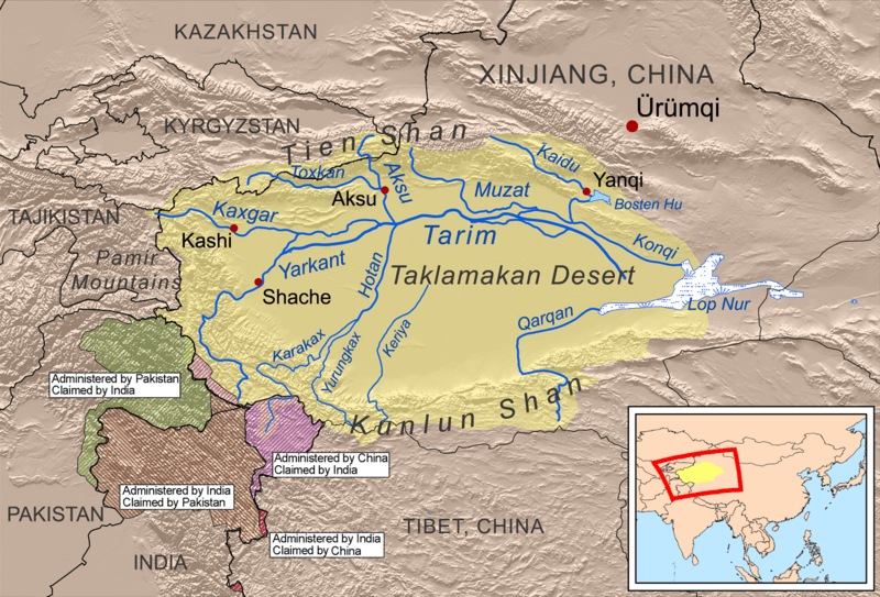
Description: This is a map of the Tarim River drainage basin. Note that river courses shown crossing the Taklamakan Desert are usually dry.
Title: Tarimrivermap
Credit: Own work using Digital Chart of the World and GTOPO data, labels based on GEOnet.
Author: Kmusser
Usage Terms: Creative Commons Attribution-Share Alike 3.0
License: CC BY-SA 3.0
License Link: http://creativecommons.org/licenses/by-sa/3.0
Attribution Required?: Yes
Image usage
The following 6 pages link to this image:

All content from Kiddle encyclopedia articles (including the article images and facts) can be freely used under Attribution-ShareAlike license, unless stated otherwise.