
Image: Territorial Expansion of the Electorate
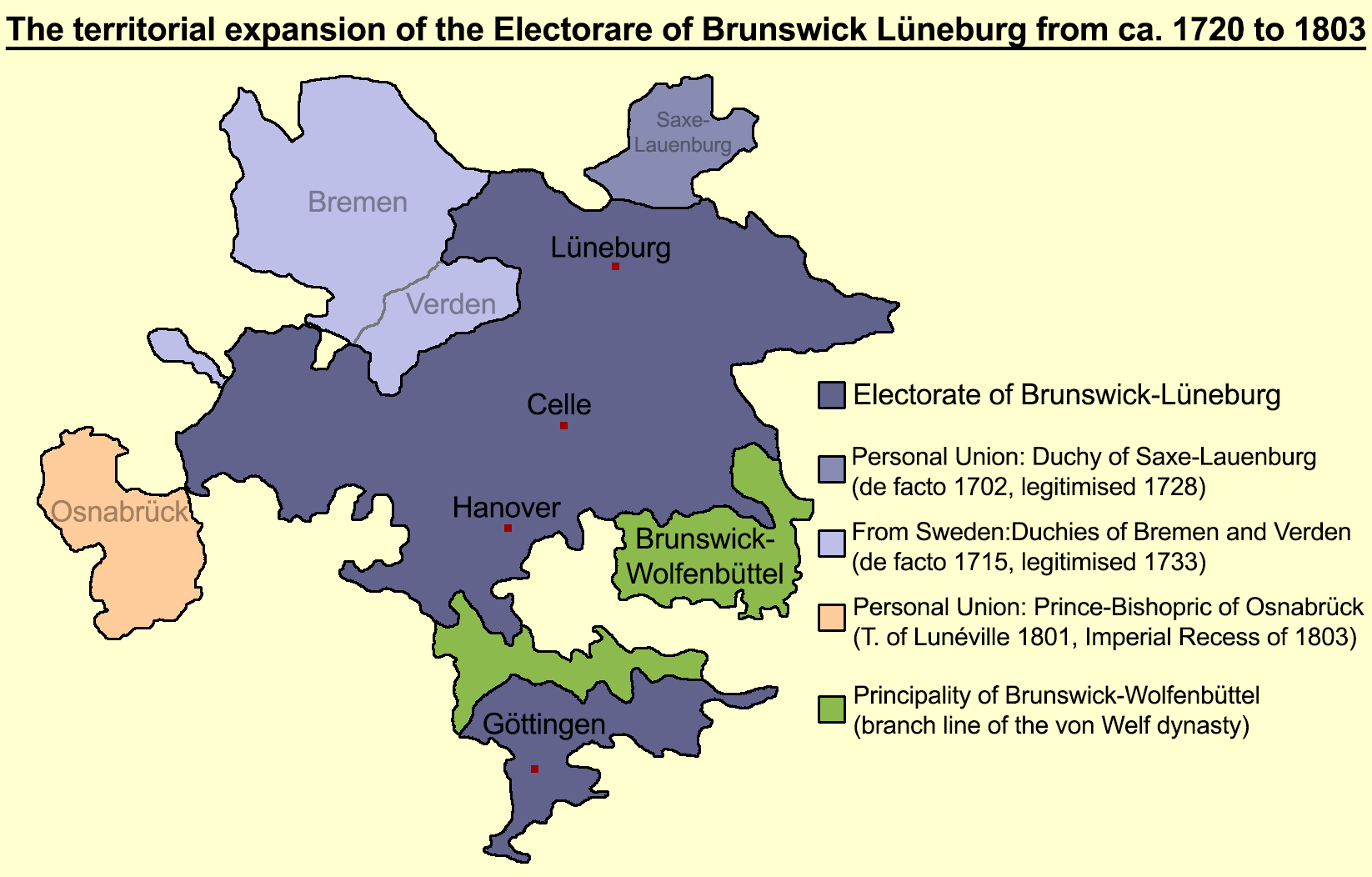
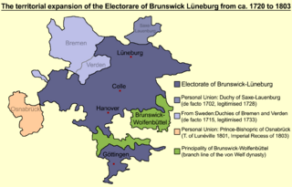
Description: Sketch map of the Duchy of Brunswick-Lüneburg including the Hanover electorate (blue) and the Principality of Brunswick-Wolfenbüttel (green), c. 1720: Elector George I Louis acquired Saxe-Lauenburg and Bremen-Verden, his successor George II Augustus gained Land Hadeln (1731, not shown in the map) and George III acquired the Prince-Bishopric of Osnabrück (1803) Polished version of this map with additional informations: https://upload.wikimedia.org/wikipedia/commons/thumb/4/49/Hanover1720.png/1024px-Hanover1720.png
Title: Territorial Expansion of the Electorate
Credit: Own work
Author: Jan10Berge
Usage Terms: Creative Commons Attribution-Share Alike 4.0
License: CC BY-SA 4.0
License Link: https://creativecommons.org/licenses/by-sa/4.0
Attribution Required?: Yes
Image usage
The following page links to this image:
