
Image: TettstedetBergen

Size of this preview: 558 × 599 pixels. Other resolutions: 223 × 240 pixels | 1,105 × 1,187 pixels.
Original image (1,105 × 1,187 pixels, file size: 817 KB, MIME type: image/jpeg)
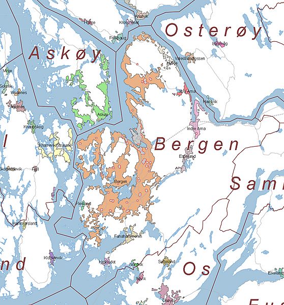
Description: Map of the urban areas in Bergen and surrounding municipalities, as defined by en:Statistics Norway. The gray spots are central areas with high levels of commercial activity.
Title: TettstedetBergen
Credit: http://www.ssb.no/tettstedkart/fylke12.pdf (cropped)
Author: Aqwis
Permission: Statistics Norway freely permits saving, printing, copying and spreading of the material on this web site (text, tables and figures). Statistics Norway must be credited when using the material. - translation of [1]
License: Attribution
Image usage
The following page links to this image:

All content from Kiddle encyclopedia articles (including the article images and facts) can be freely used under Attribution-ShareAlike license, unless stated otherwise.