
Image: The Battle of the Monongahela WDL9580
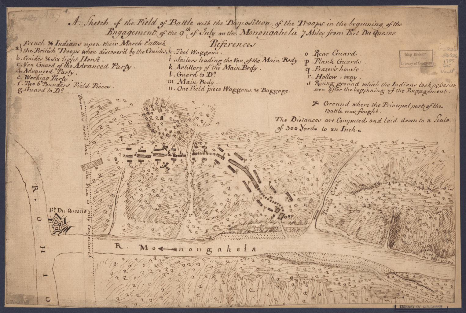
Description: This manuscript pen-and-ink map shows the disposition of troops at the beginning of the Battle of Monongahela, which took place on July 9, 1755, in the second year of the French and Indian War. Determined to drive the French out of western Pennsylvania, the British had sent a force of 2,000 army regulars and colonial militia commanded by General Edward Braddock to capture Fort Duquesne, located at the confluence of the Allegheny and Monongahela rivers in what is now downtown Pittsburgh. After an arduous march through northern Virginia and western Maryland, Braddock turned north into Pennsylvania. On July 9, Braddock and a column of 1,300 men crossed the Monongahela River and began heading toward the fort, some ten miles (16 kilometers) downstream. They were attacked by a small detachment of French soldiers and several hundred Indian allies, including Ottawas, Miamis, Hurons, Delawares, Shawnees, and Iroquois. The British suffered a disastrous defeat: approximately 500 soldiers, including Braddock himself, were killed, and more than 450 were wounded. Among the survivors was Colonel George Washington, an aide to Braddock and commander of the Virginia Regiment. Allegheny River (Pennsylvania and New York); Battlefields; Battles; Great Britain--Colonies; Monongahela River Valley (West Virginia and Pennsylvania); Monongahela, Battle of the, Pennsylvania, 1755; Ohio River; Pittsburgh Region (Pennsylvania); United States -- History -- French and Indian War, 1754-1763
Title: The Battle of the Monongahela
Credit: http://dl.wdl.org/9580.png Gallery: http://www.wdl.org/en/item/9580/
Usage Terms: Public domain
License: Public domain
Attribution Required?: No
Image usage
The following page links to this image:
