
Image: The Blue Anchor Fault - geograph.org.uk - 2455274
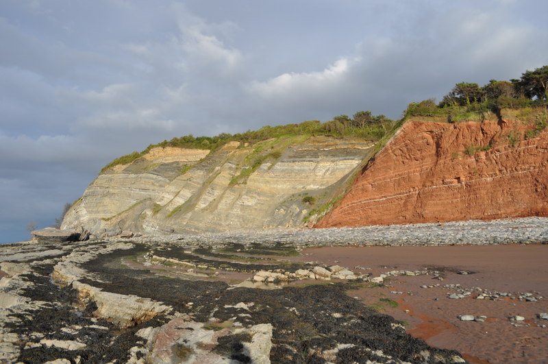
Description: The Blue Anchor Fault Possibly the most obvious fault in Britain. The red rock with reduction horizons is Triassic Mercia Mudstone (MMS). To the left there are younger rocks, Late to Latest Triassic (Norian-Rhaetian) and/or Earliest Jurassic interbedded marls and muds (with evaporites like gypsum). You can tell this is a normal fault, this means the younger strata has slid downwards to sit beside the MMS. Also near the fault in the MMS the lighter reduction horizons are dipping downwards probably due to marginal drag. The line of the fault runs along the beach, shown by the rock/sand divide.
Title: The Blue Anchor Fault - geograph.org.uk - 2455274
Credit: From geograph.org.uk; transferred by User:Rubberstamp using geograph_org2commons.
Author: Ashley Dace
Permission: Creative Commons Attribution Share-alike license 2.0
Usage Terms: Creative Commons Attribution-Share Alike 2.0
License: CC BY-SA 2.0
License Link: http://creativecommons.org/licenses/by-sa/2.0
Attribution Required?: Yes
Image usage
The following page links to this image:
