
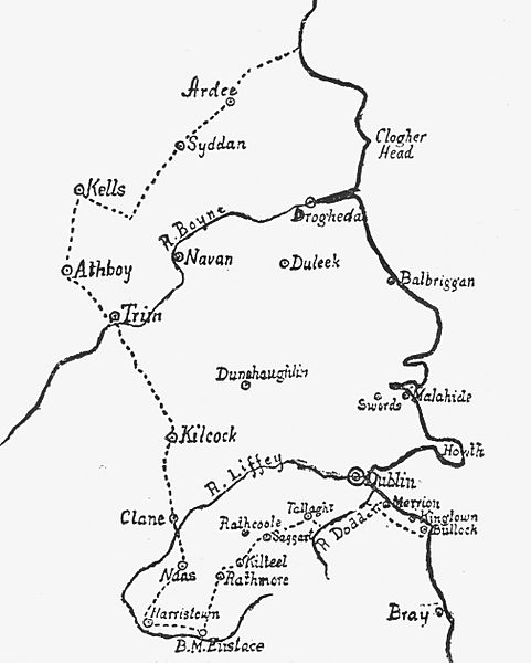
Image: The Pale According to the Statute of 1488 edit

Size of this preview: 481 × 600 pixels. Other resolutions: 192 × 240 pixels | 2,018 × 2,517 pixels.
Original image (2,018 × 2,517 pixels, file size: 823 KB, MIME type: image/jpeg)
Description: The Pale, or the English Pale, according to the Statute of 1488. A map of that area of Ireland commonly known as the Pale which, by the the 15th century, was under effective English colonial rule.
Title: The Pale According to the Statute of 1488 edit
Credit: Weston St. John Joyce (1858-1939), 'The Neighbourhood of Dublin' (Dublin, 1921) & File:The Pale According to the Statute of 1488.jpg
Author: Weston St. John Joyce
Usage Terms: Public domain
License: Public domain
Attribution Required?: No
Image usage
The following page links to this image:

All content from Kiddle encyclopedia articles (including the article images and facts) can be freely used under Attribution-ShareAlike license, unless stated otherwise.