
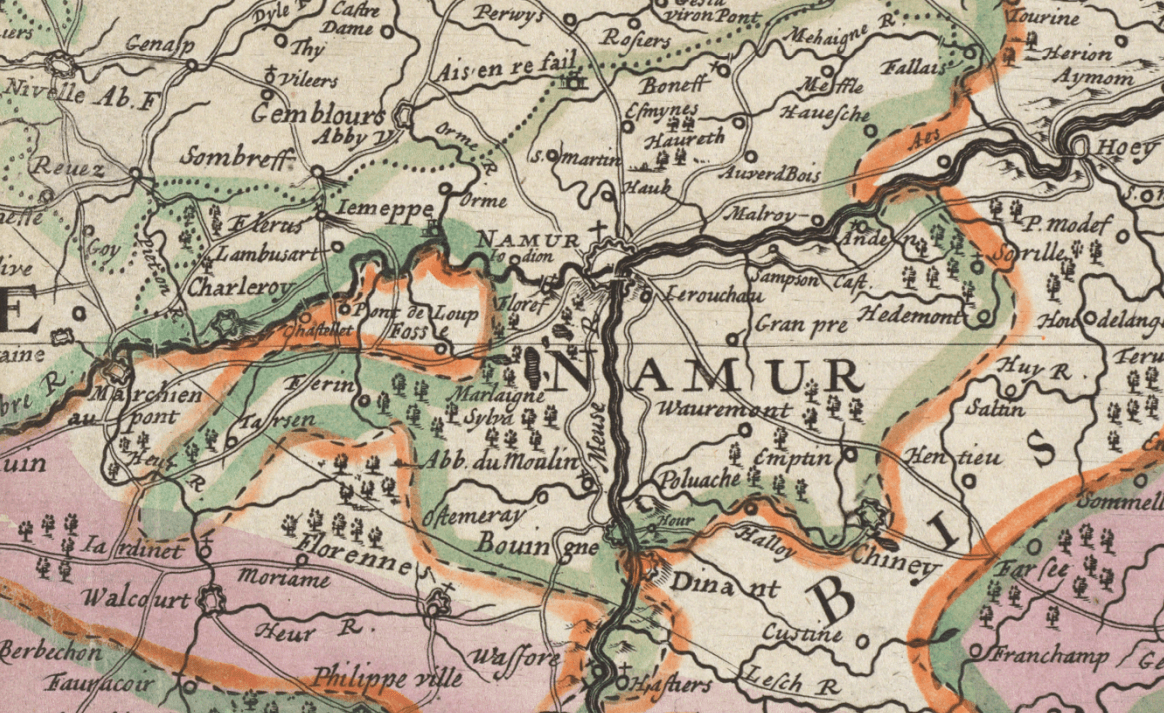
Image: The Spainish Netherlands 1690 detail Namur
Size of this preview: 800 × 490 pixels. Other resolutions: 320 × 196 pixels | 1,164 × 713 pixels.
Original image (1,164 × 713 pixels, file size: 705 KB, MIME type: image/png)
Description: Detail of the 1690 map "The Spainish Netherlands..." by Herman Moll. It shows the city of Namur and the surrounding region, where the battles of the siege of Namur (1692) occurred.
Title: The Spainish Netherlands 1690 detail Namur
Credit: Detail of The Spainish Netherlands, vulgarly called Flanders, devided into its X provinces, wherein are delineated the fortified towns roads &c. (8343559334).jpg
Author: Herman Moll
Usage Terms: Public domain
License: Public domain
Attribution Required?: No
Image usage
The following page links to this image:

All content from Kiddle encyclopedia articles (including the article images and facts) can be freely used under Attribution-ShareAlike license, unless stated otherwise.