
Image: Theodosius I's empire
No higher resolution available.
Theodosius_I's_empire.png (563 × 406 pixels, file size: 24 KB, MIME type: image/png)
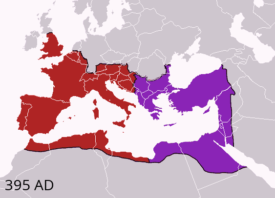
Description: Map of the boundaries of the western and eastern Roman empires after the death of Theodosius I, in 395 AD. Western Roman Empire Eastern Roman (Byzantine) Empire
Title: Theodosius I's empire
Credit: Made personally from Image:BlankMap-Europe-v3.png, using (2004). The Collins Atlas of World History. Wiltshire: HarperCollins, 46-47. 0-00-716640-0. and Image:Roman empire 395.jpg as a source.
Author: Geuiwogbil at en.wikipedia
Usage Terms: Creative Commons Attribution-Share Alike 3.0
License: CC-BY-SA-3.0
License Link: http://creativecommons.org/licenses/by-sa/3.0/
Attribution Required?: Yes
Image usage
The following 4 pages link to this image:

All content from Kiddle encyclopedia articles (including the article images and facts) can be freely used under Attribution-ShareAlike license, unless stated otherwise.