
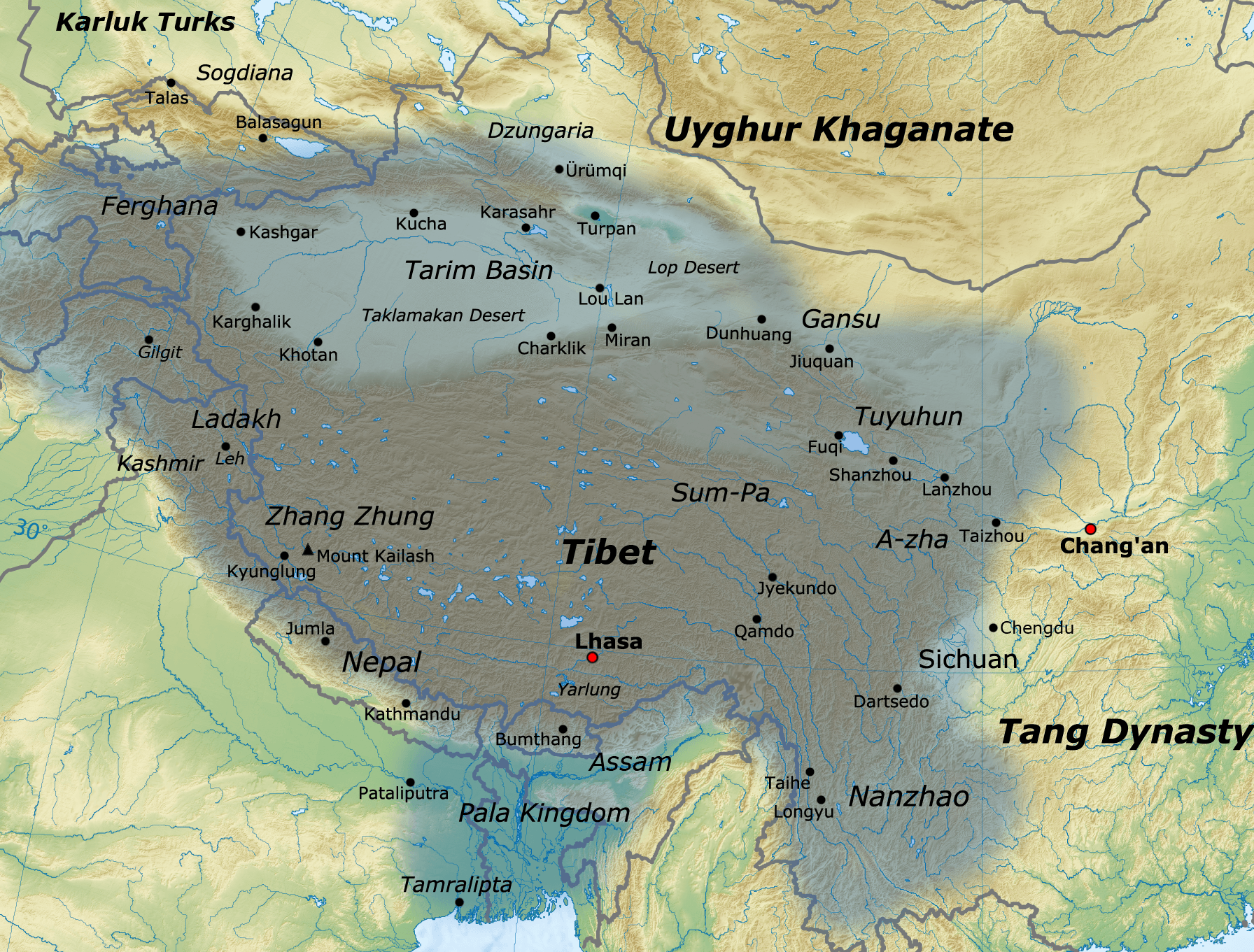
Image: Tibetan empire greatest extent 780s-790s CE
Description: Map of the Tibetan Empire at its greatest extent between the 780s and the 790s CE sources: http://academic.reed.edu/anthro/364/maps.html http://unitednations4freetibet.com/unfft/wp-content/uploads/2010/11/The-Nation-of-T ibet.pdf http://sitemaker.umich.edu/mladjov/files/china800.jpg http://www.lib.utexas.edu/maps/middle_east_and_asia/china_map_folio/txu-oclc-588534-54930-10-67-map.jpg The Silk Road: trade, travel, war and faith By Susan Whitfield, British Library http://www.tew.org/geography/historical.map1.html http://qed.princeton.edu/getfile.php?f=The_Chinese_world,_7th-8th_centuries.jpg http://pages.uoregon.edu/kimball/images/1294.ASA-CWA153.jpg
Title: Tibetan empire greatest extent 780s-790s CE
Credit: Own work
Author: Javierfv1212
Usage Terms: Creative Commons Attribution 3.0
License: CC BY 3.0
License Link: http://creativecommons.org/licenses/by/3.0
Attribution Required?: Yes
Image usage
The following 6 pages link to this image:
