
Image: Tiden loc
Size of this preview: 417 × 599 pixels. Other resolutions: 167 × 240 pixels | 2,231 × 3,203 pixels.
Original image (2,231 × 3,203 pixels, file size: 323 KB, MIME type: image/png)
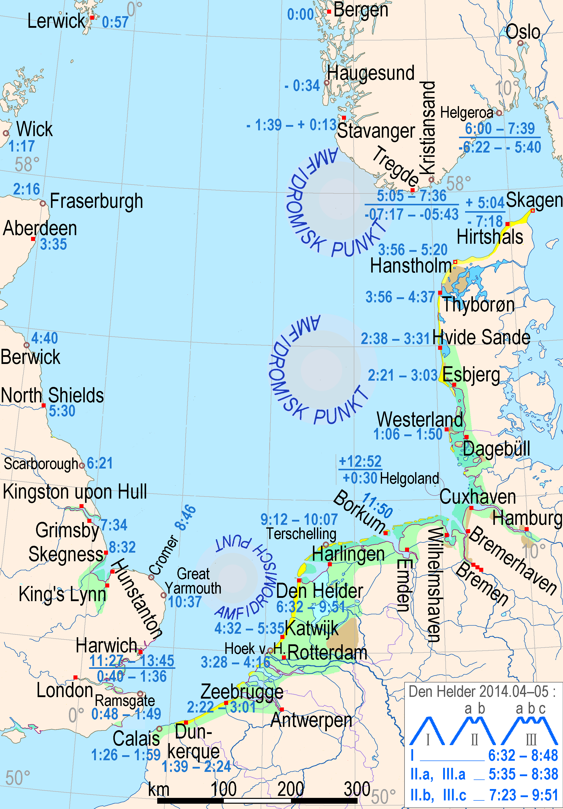
Description: Location map for the list of selected tide ranges on southern North Sea, timelines of the tide waves (three synchronous amphidromic circles), coastal marshes (green), mudflats (jade), lagoons (bright blue), dunes (yellow), sea dikes (purple), moraines near the coast (light brown), rock-based coasts (grayish brown)]]
Title: Tiden loc
Credit: Own work
Author: Ulamm (talk) 23:35, 17 March 2014 (UTC)
Usage Terms: Creative Commons Attribution-Share Alike 3.0
License: CC BY-SA 3.0
License Link: http://creativecommons.org/licenses/by-sa/3.0
Attribution Required?: Yes
Image usage
The following page links to this image:

All content from Kiddle encyclopedia articles (including the article images and facts) can be freely used under Attribution-ShareAlike license, unless stated otherwise.