
Image: Tillemon & Coronelli Nouveau Mexique 1687 UTA
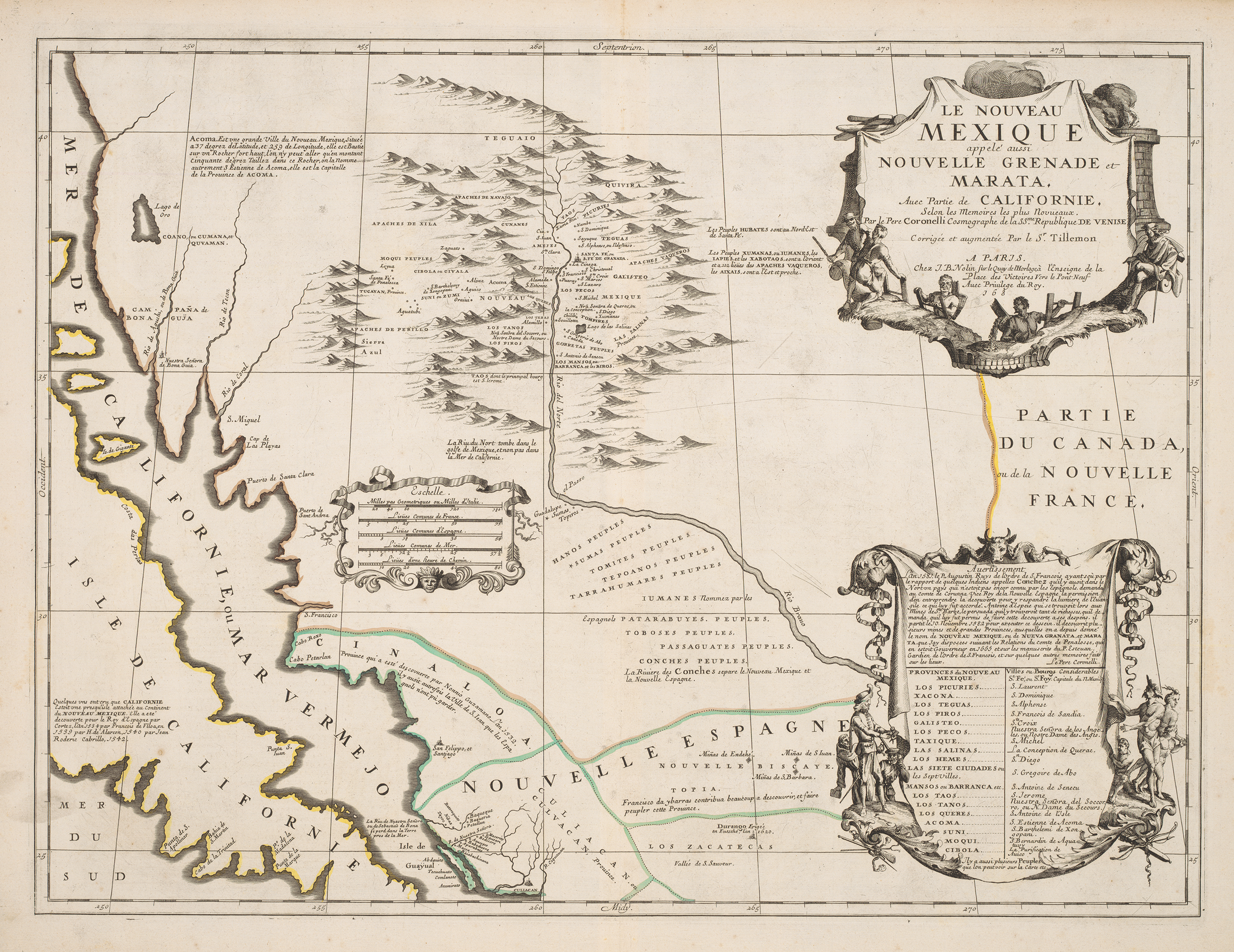
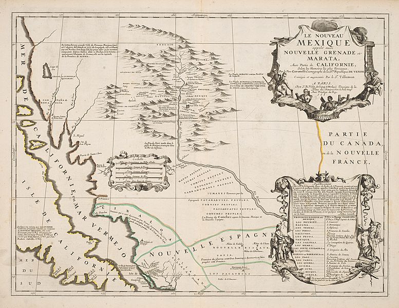
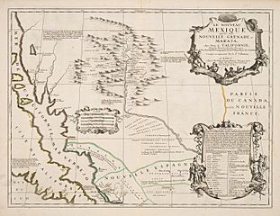
Description: While the famed Venetian cartographer and Minorite friar Vincenzo Coronelli spent time in France as cartographer and globe-maker to Louis XIV, he was able to compile valuable geographic knowledge about New Spain's interior provinces. One of his most important sources was a manuscript map drawn by Abbé Claude Bernou based upon information from a former governor of New Mexico (1661-1664), the self-proclaimed Comte, don Diego Dionisio de Peñalosa Briceño y Berdugo (1621-1687). Peñalosa had been banished by the Inquisition for alleged misdeeds and had traveled to London and by 1678 was in France, where he offered his services to the French. Tillemon's and Coronelli's maps as published by Jean-Baptiste Nolin not only spread knowledge of many place names for the first time, such as "el Passo" (modern Juarez, Mexico), they also showed that the "Rio del Norte" and "Rio Bravo" were one and the same. One particularly interesting toponym near the "Moqui Peuples" (Hopi people) is the town or village of "Santa Fé de Peñalossa" – apparently a fabrication.
Title: Le Nouveau Mexique appelé aussi Nouvelle Grenade et Marata, avec Partie de Californie
Credit: UTA Libraries Cartographic Connections: map / text
Author: Jean Nicolas Du Tralage
Usage Terms: Public domain
License: Public domain
Attribution Required?: No
Image usage
The following page links to this image:
