
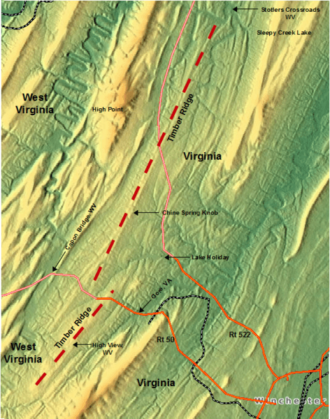
Image: Timber Ridge (map of), a geographic feature on the border of VA and WV (USA)

Size of this preview: 472 × 600 pixels. Other resolutions: 189 × 240 pixels | 533 × 677 pixels.
Original image (533 × 677 pixels, file size: 728 KB, MIME type: image/png)
Description: The ridge is marked by dashed red lines on a relief map. Their locations were discerned from USGS topographic maps. Also shown are states, towns, and other landmarks.
Title: Timber Ridge (map of), a geographic feature on the border of VA and WV (USA)
Credit: Own work Background relief map by Hans Braxmeier, http://www.maps-for-free.com/
Author: Bob K
Permission: Own work submitted to the public domain. Relief map courtesy of http://www.maps-for-free.com/ under GNU Free Documentation License.
Usage Terms: GNU Free Documentation License
License: GFDL
License Link: http://www.gnu.org/copyleft/fdl.html
Attribution Required?: Yes
Image usage
The following page links to this image:

All content from Kiddle encyclopedia articles (including the article images and facts) can be freely used under Attribution-ShareAlike license, unless stated otherwise.
,_a_geographic_feature_on_the_border_of_VA_and_WV_(USA).png)