
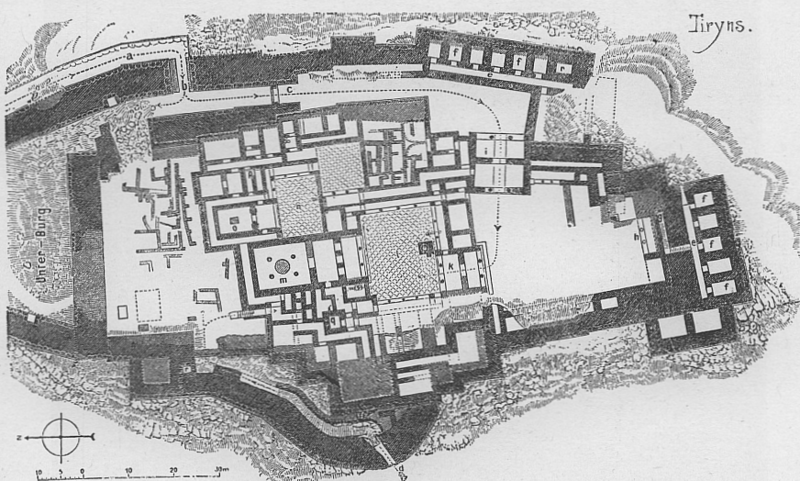
Image: Tiryns, map of the palace and the surrounding fortifications

Size of this preview: 800 × 481 pixels. Other resolutions: 320 × 192 pixels | 872 × 524 pixels.
Original image (872 × 524 pixels, file size: 663 KB, MIME type: image/png)
Description: Tiryns, Greece, map of palace
Title: Tiryns, map of the palace and the surrounding fortifications
Credit: Selbst eingescannt aus Gustav Ebe: Kunstgeschichte des Altertums, Düsseldorf, 1895, S. 219.
Author: Gustav Ebe (1834–1916)
Usage Terms: Public domain
License: Public domain
Attribution Required?: No
Image usage
The following image is a duplicate of this image (more details):
The following 2 pages link to this image:

All content from Kiddle encyclopedia articles (including the article images and facts) can be freely used under Attribution-ShareAlike license, unless stated otherwise.