
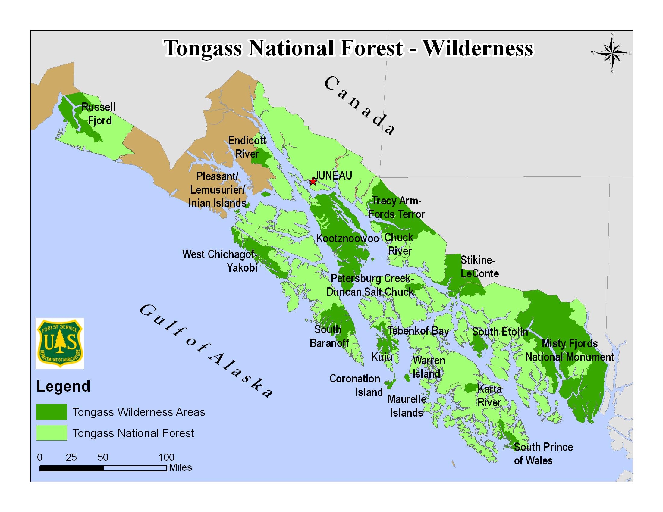
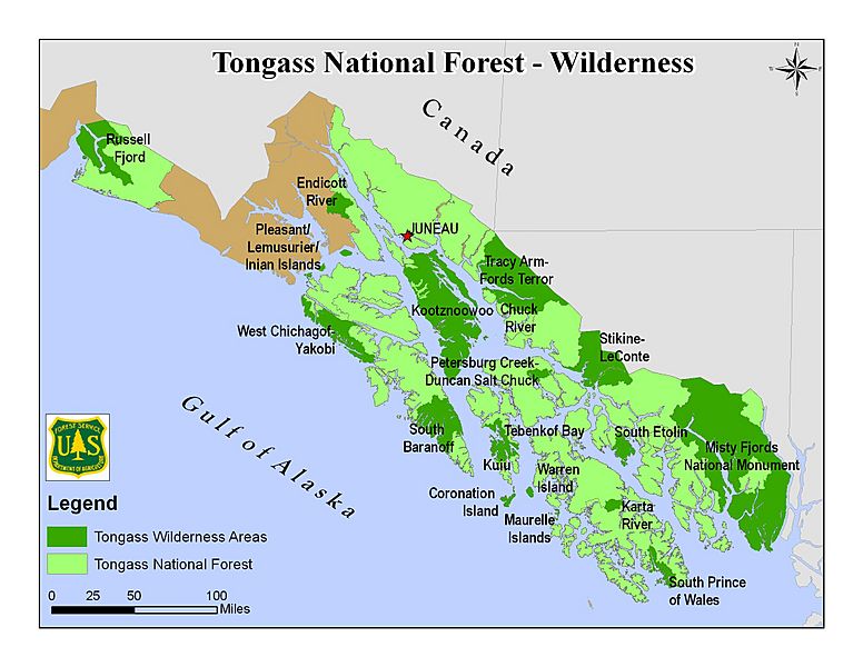
Image: Tongass NF - map of wilderness areas
Size of this preview: 776 × 600 pixels. Other resolutions: 311 × 240 pixels | 2,200 × 1,700 pixels.
Original image (2,200 × 1,700 pixels, file size: 954 KB, MIME type: image/jpeg)
Description: Map of the Tongass National Forest in southeast Alaska, USA, showing designated Wilderness Areas
Title: Tongass NF - map of wilderness areas
Credit: https://www.fs.usda.gov/detail/tongass/specialplaces/?cid=stelprdb5393510
Author: U.S. Forest Service
Permission: Public domainPublic domainfalsefalse This image is a work of the Forest Service of the United States Department of Agriculture. As a work of the U.S. federal government, the image is in the public domain.
Usage Terms: Public domain
License: Public domain
Attribution Required?: No
Image usage
The following page links to this image:

All content from Kiddle encyclopedia articles (including the article images and facts) can be freely used under Attribution-ShareAlike license, unless stated otherwise.