
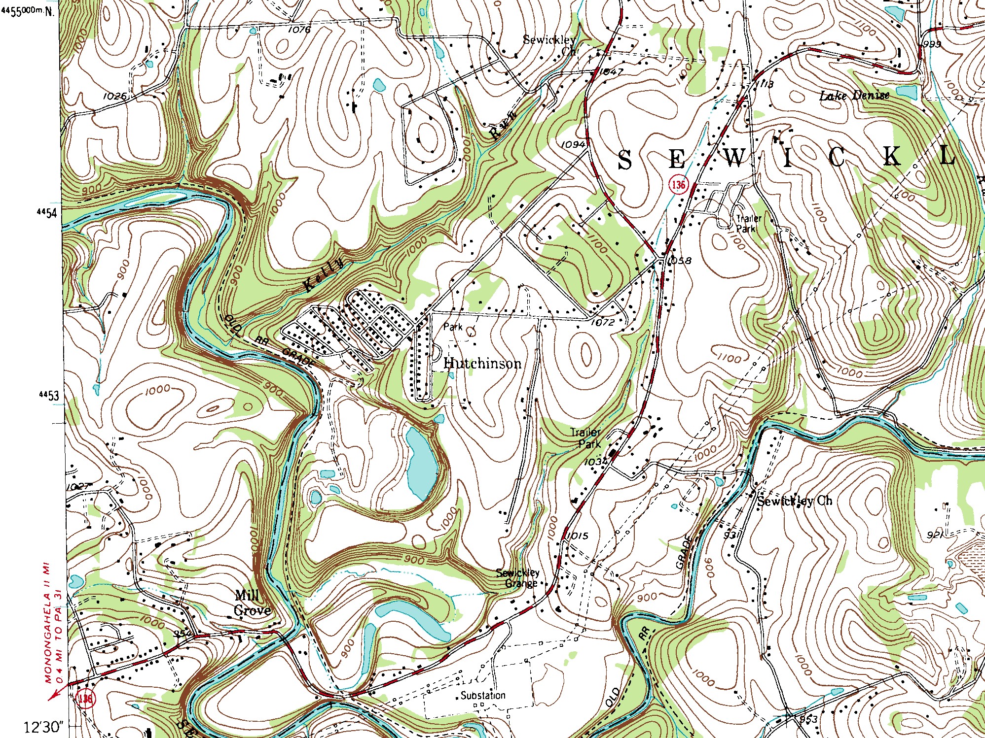
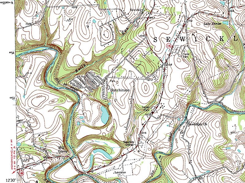
Image: Topographic Survey Map of Hutchinson
Size of this preview: 799 × 599 pixels. Other resolutions: 320 × 240 pixels | 1,997 × 1,498 pixels.
Original image (1,997 × 1,498 pixels, file size: 1.36 MB, MIME type: image/jpeg)
Description: Contour interval 20 feet. National Geodetic Vertical Datum of 1929.
Title: Topographic Survey Map of Hutchinson
Credit: Topographic Survey Map of Hutchinson from the Smithton, Pennsylvania, NW/4 Connellsville 15' Quadrangle.
Author: U.S.Geological Survey
Usage Terms: Public domain
License: Public domain
Attribution Required?: No
Image usage
The following image is a duplicate of this image (more details):
The following page links to this image:

All content from Kiddle encyclopedia articles (including the article images and facts) can be freely used under Attribution-ShareAlike license, unless stated otherwise.