
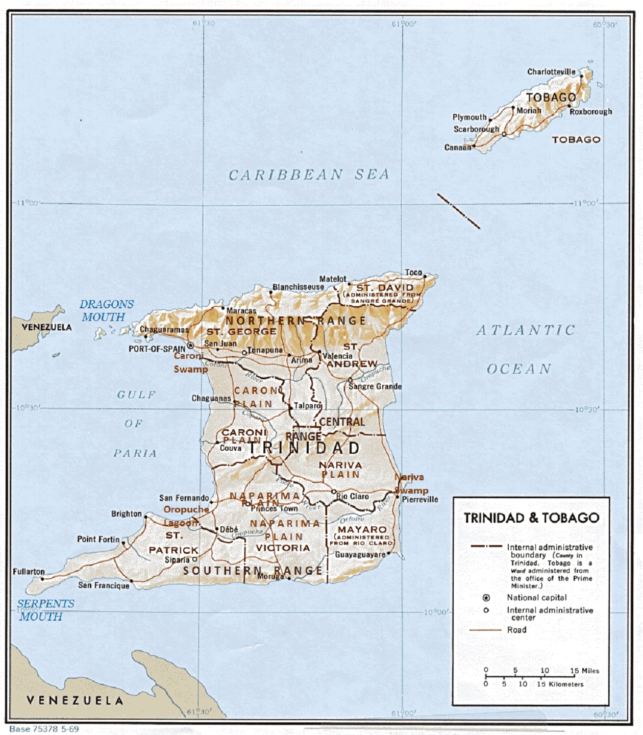
Image: Trinidad and Tobago Shaded Relief PCL Texas Annotated
Description: A annotated shaded relief map of the island of Trinidad, showing the major mountain ranges, rivers, plains, swamps, and straits. Public domain map annotated by Fowler&fowler (talk) 19:57, 14 October 2013 (UTC)
Title: Trinidad and Tobago Shaded Relief PCL Texas Annotated
Credit: http://www.lib.utexas.edu/maps/americas.html
Author: US-Central Intelligence Agency. Annotated to highlight geographical features by Fowler&fowler (talk) 19:57, 14 October 2013 (UTC)
Permission: Public domainPublic domainfalsefalse This image is a work of a Central Intelligence Agency employee, taken or made as part of that person's official duties. As a Work of the United States Government, this image or media is in the public domain in the United States. čeština ∙ Deutsch ∙ eesti ∙ English ∙ español ∙ français ∙ italiano ∙ português ∙ polski ∙ sicilianu ∙ slovenščina ∙ suomi ∙ Tiếng Việt ∙ български ∙ македонски ∙ русский ∙ українська ∙ বাংলা ∙ മലയാളം ∙ 한국어 ∙ 日本語 ∙ 中文 ∙ 中文(简体) ∙ 中文(繁體) ∙ العربية ∙ پښتو ∙ +/−
Usage Terms: Public domain
License: Public domain
Attribution Required?: No
Image usage
The following page links to this image:
