
Image: Tularosa-Basin-NM-USGS-map
Size of this preview: 447 × 599 pixels. Other resolutions: 179 × 240 pixels | 624 × 836 pixels.
Original image (624 × 836 pixels, file size: 61 KB, MIME type: image/gif)
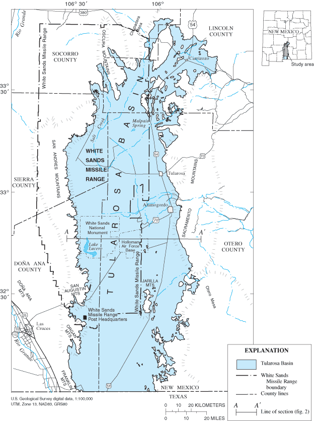
Description: Location map of Tularosa Basin 2004
Title: Tularosa-Basin-NM-USGS-map
Credit: Huff, Glenn F. (2005) "Simulation of Ground-Water Flow in the Basin-Fill Aquifer of the Tularosa Basin, South-Central New Mexico, Predevelopment through 2040" Scientific Investigations Report 2004-5197, United States Geological Survey, Washongton, D.C., fig. 1.
Author: Huff, Glenn F. (United States Geological Survey)
Permission: Public Domain
Usage Terms: Public domain
License: Public domain
Attribution Required?: No
Image usage
The following page links to this image:

All content from Kiddle encyclopedia articles (including the article images and facts) can be freely used under Attribution-ShareAlike license, unless stated otherwise.