
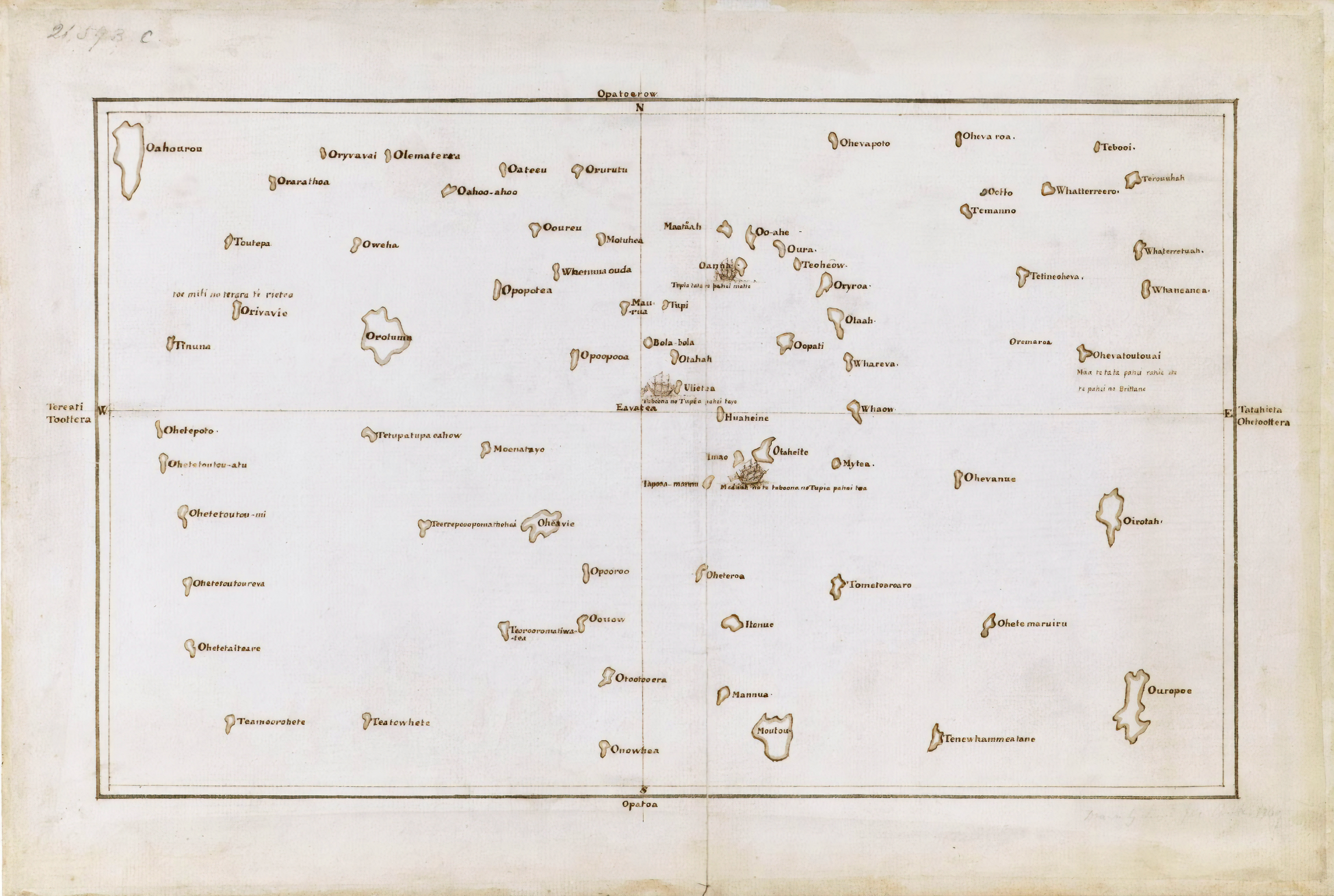
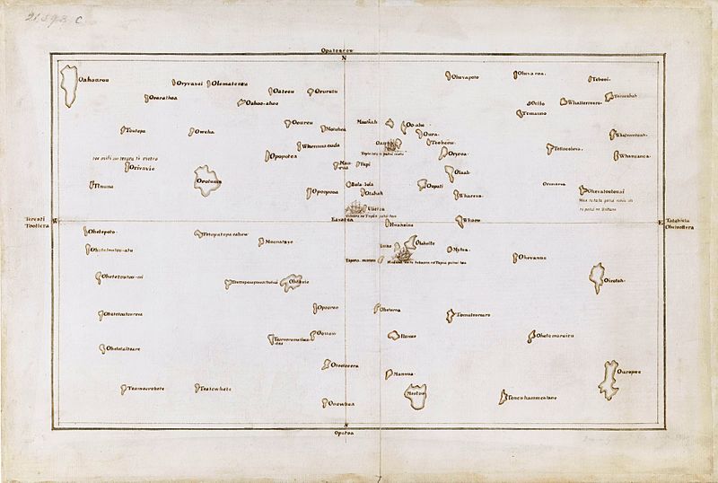
Image: Tupaia's map, c. 1769
Size of this preview: 800 × 538 pixels. Other resolutions: 320 × 215 pixels | 7,657 × 5,145 pixels.
Original image (7,657 × 5,145 pixels, file size: 15.67 MB, MIME type: image/jpeg)
Description: Tupaia's chart of the islands surrounding Tahiti in Oceania
Title: Tupaia's map, c. 1769
Credit: British Library, London. https://alchetron.com/Tupaia-(navigator)-1088442-W#- http://www.britishempire.co.uk/images4/tupaiamaplarge.jpg http://www.strangehistory.net/blog/wp-content/uploads/2011/03/tupaia-map.jpg
Author: James Cook
Usage Terms: Public domain
License: Public domain
Attribution Required?: No
Image usage
The following page links to this image:

All content from Kiddle encyclopedia articles (including the article images and facts) can be freely used under Attribution-ShareAlike license, unless stated otherwise.