
Image: Twin Cities 7 Metro map
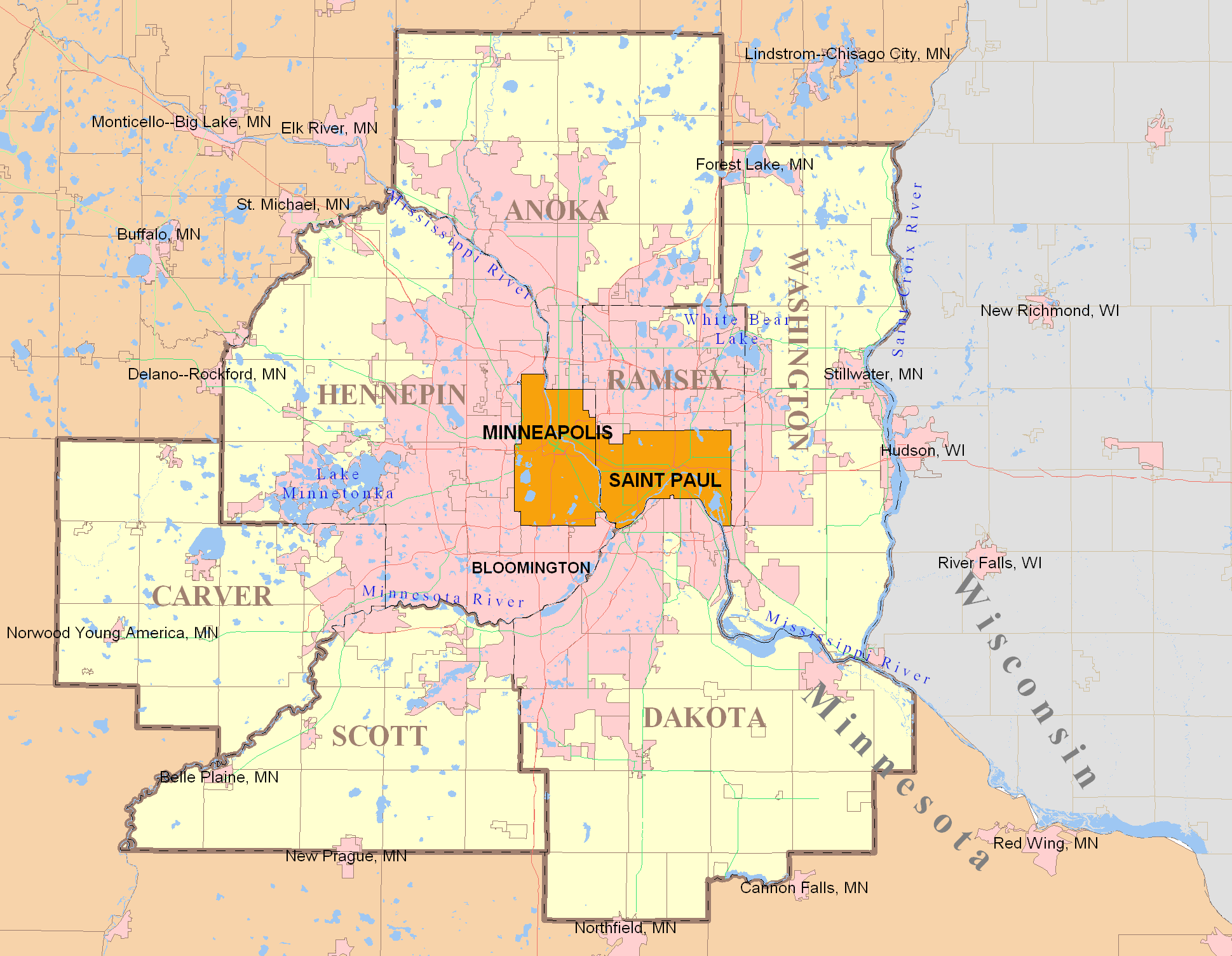
Description: Twin Cities 7-County Metropolitan Area with labels. The grey shaded portion is Wisconsin. Note this 7-County definition is outdated by the expanded 11-County metro map which includes counties in Wisconsin (search Commons for it). The U.S. Census Bureau sets these definitions which were adopted by the regional government (Metropolitan Council). This map has some slight errors. All pink areas are "urbanized areas" meaning serviced by some wastewater agency and not zoned rural. However only the contiguous pink area stretching from the two core cities of Minneapolis and Saint Paul are considered part of the metropolitan Twin Cities which are both defined by law and by cultural consciousness. This contiguous urban area is called the Metro Urban Service Area boundary (MUSA) as defined by the Metropolitan Council, the regional government. The regional wastewater system allows high-density development. Some of the outer cities (small towns) are connected to the the regional system noted by the updated 11-County map. Other lines: The greyish grid-like lines are municipal boundaries of the many suburbs surrounding the core cities of MSP. As you can see some suburbs have non-urbanized areas. The light red lines that seem to weave the inner area of the pink is the interstate highway system, which is now eclipsed by an expanding urban area. The urbanized area answers to the Met Council and not the core cities of Mpls or StP. As you can see, the ratio of actual core city area is very low. Map is produced via MapInfo Professional using only publicly available data from government agencies.
Title: Twin Cities 7 Metro map
Credit: Own work
Author: Davumaya
Usage Terms: Creative Commons Attribution 3.0
License: CC BY 3.0
License Link: https://creativecommons.org/licenses/by/3.0
Attribution Required?: Yes
Image usage
The following 26 pages link to this image:
- Anoka Post Office
- Banfill Tavern
- Basilica of Saint Mary (Minneapolis)
- Bde Maka Ska
- Burbank–Livingston–Griggs House
- Casiville Bullard House
- Charles Spangenberg Farmstead
- Charles Thompson Memorial Hall
- Cordenio Severance House
- Crescent Grange Hall No. 512
- Croixsyde
- George W. Wentworth House
- Germania Bank Building (St. Paul)
- H. G. Leathers House
- Heman L. Ticknor House
- Hennepin Center for the Arts
- Henry Stussi House
- John P. Furber House
- Lake Harriet (Minnesota)
- Lake Hiawatha
- Lakeville, Minnesota
- Riverside Hangar
- Riverside Hotel (St. Francis, Minnesota)
- Saint Joseph's Academy (Saint Paul, Minnesota)
- Shaw–Hammons House
- Stillwater Overlook
