
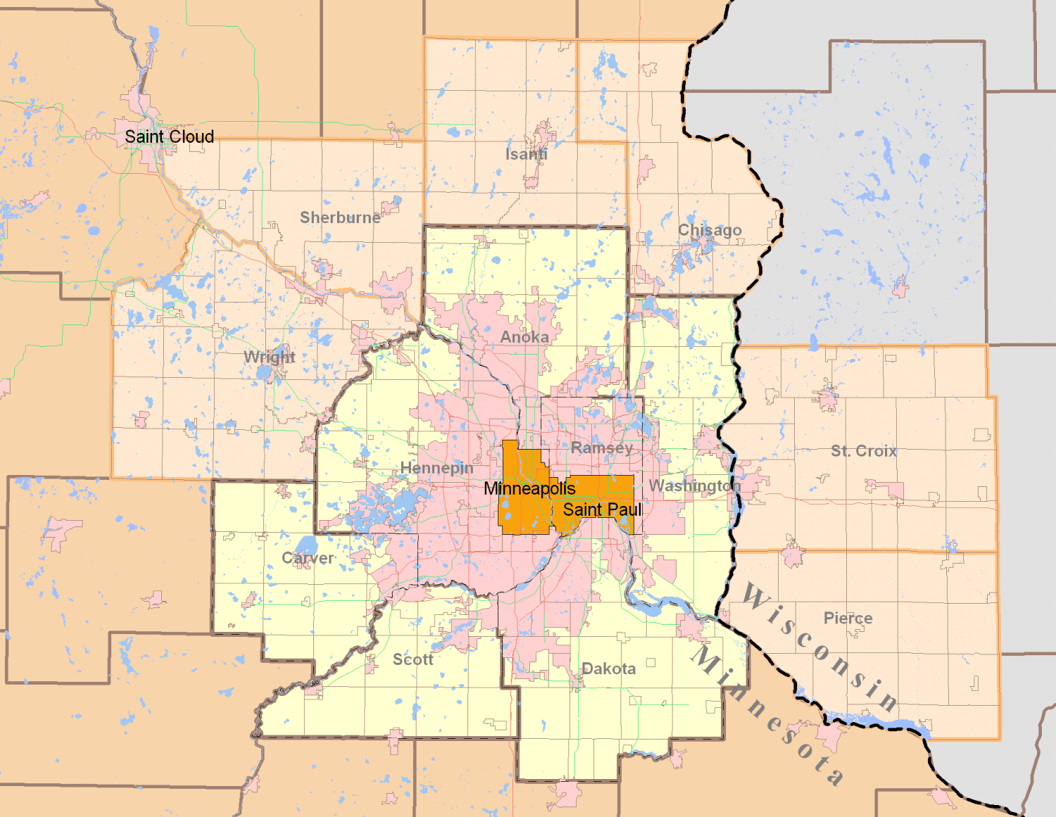
Image: Twin Cities Metro Area (13 County)
Description: Minneapolis-Saint Paul (Twin Cities) highlighting both the 7-county Urban Area (traditional) and the revised 13-county Metropolitan Statistical Area from the 2000 Census. Today, the term Twin Cities typically refers to the metropolitan area. The pink areas represent urbanized areas as defined by the Metropolitan Council (urbanized meaning developed with sewer access and includes suburbia and small towns). The red and green lines are highways while the grid-like lines within the counties are township boundaries and mostly rural. Suburban cities are also defined within the pink area however they are not as apparent since their borders so regularly match up with existing highways and natural features.
Title: Twin Cities Metro Area (13 County)
Credit: Own work by uploader using publicly and freely available cartographic data by state and private agencies. Raster by MapInfo, purchased for personal use and distributed for no monetary gain.
Author: Davumaya
Permission: Agencies providing this data and myself make no assertion that this data is an accurate representation or legally defined. It is provided as a fair representation and should not be used for legal purposes.
Usage Terms: Creative Commons Attribution-Share Alike 3.0
License: CC BY-SA 3.0
License Link: http://creativecommons.org/licenses/by-sa/3.0
Attribution Required?: Yes
Image usage
The following page links to this image:

.png)