
Image: Tyne and Wear UK location map

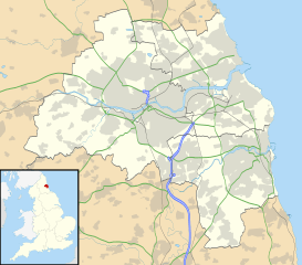
Description: Map of Tyne and Wear, UK with the following information shown: Administrative borders Coastline, lakes and rivers Roads and railways Urban areas Equirectangular map projection on WGS 84 datum, with N/S stretched 170% Geographic limits: West: 1.90W East: 1.30W North: 55.09N South: 54.78N
Title: Tyne and Wear UK location map
Credit: Ordnance Survey OpenData. Administrative borders and coastline data from Boundary-Line product. All other geographic data from Meridian 2 product. Inset derived from England location map.svg by Spischot.
Author: Nilfanion, created using Ordnance Survey data
Permission: This file is licensed under the Creative Commons Attribution-Share Alike 3.0 Unported license. Attribution: Contains Ordnance Survey data © Crown copyright and database right You are free: to share – to copy, distribute and transmit the work to remix – to adapt the work Under the following conditions: attribution – You must attribute the work in the manner specified by the author or licensor (but not in any way that suggests that they endorse you or your use of the work). share alike – If you alter, transform, or build upon this work, you may distribute the resulting work only under the same or similar license to this one. http://creativecommons.org/licenses/by-sa/3.0 CC BY-SA 3.0 Creative Commons Attribution-Share Alike 3.0 truetrue
Usage Terms: Creative Commons Attribution-Share Alike 3.0
License: CC BY-SA 3.0
License Link: http://creativecommons.org/licenses/by-sa/3.0
Attribution Required?: Yes
Image usage
The following 83 pages link to this image:
- All Saints' Church, Monkwearmouth
- All Saints' Church, Newcastle upon Tyne
- Arbeia
- Army Riding School, Newcastle upon Tyne
- Barrack Road drill hall, Newcastle upon Tyne
- Birtley, Tyne and Wear
- Castletown, Sunderland
- Clara Vale
- Claxheugh
- Cleadon
- Concord, Sunderland
- Condercum
- Cox Green, Tyne and Wear
- Farringdon, Sunderland
- Fatfield Woods
- Fulwell, Sunderland
- Gateshead
- Gosforth Nature Reserve
- Grangetown, Sunderland
- GreyFriars, Newcastle-upon-Tyne
- Grindon, Sunderland
- Hastings Hill
- Haymarket Metro station
- Heaton, Newcastle upon Tyne
- Hendon, Sunderland
- Hetton-le-Hole
- Holy Name parish, Jesmond
- Holy Trinity Church, Sunderland
- Hutton Terrace drill hall, Newcastle upon Tyne
- Jarrow
- Joe's Pond
- Killingworth
- Marsden, Tyne and Wear
- Milecastle 0
- Milecastle 1
- Milecastle 10
- Milecastle 11
- Milecastle 2
- Milecastle 3
- Milecastle 4
- Milecastle 5
- Milecastle 6
- Milecastle 7
- Milecastle 8
- Milecastle 9
- Millfield, Tyne and Wear
- Millfield Metro station
- Morden Tower
- Newbottle, Tyne and Wear
- North Shields
- Ouseburn Valley
- Philadelphia, Tyne and Wear
- Prestwick Carr
- Rainton Meadows
- Ravensworth Castle (Tyne and Wear)
- Ryhope
- Ryton, Tyne and Wear
- Sacred Heart Church, North Gosforth
- Segedunum
- Souter Lighthouse
- South Hylton
- South Shields
- Southwick, Sunderland
- St John the Baptist Church, Newcastle upon Tyne
- St Mary's Lighthouse
- St Michael and All Angels' Church, Houghton-le-Spring
- St Paul's Church, Winlaton
- Stockton Road United Reformed Church
- Sunderland
- Sunderland Minster
- The Castle, Newcastle
- Tunstall, Sunderland
- Tunstall Hills
- Tynemouth
- Tynemouth Castle and Priory
- Victoria Tunnel (Newcastle)
- Wallsend
- Washing Wells Roman Fort
- Washington, Tyne and Wear
- Whitburn, Tyne and Wear
- Whitley Bay
- Witherwack
- Template:Location map United Kingdom Tyne and Wear
