
Image: UNOSAT GazaStrip Damage Review 19Feb09 v3 Lowres
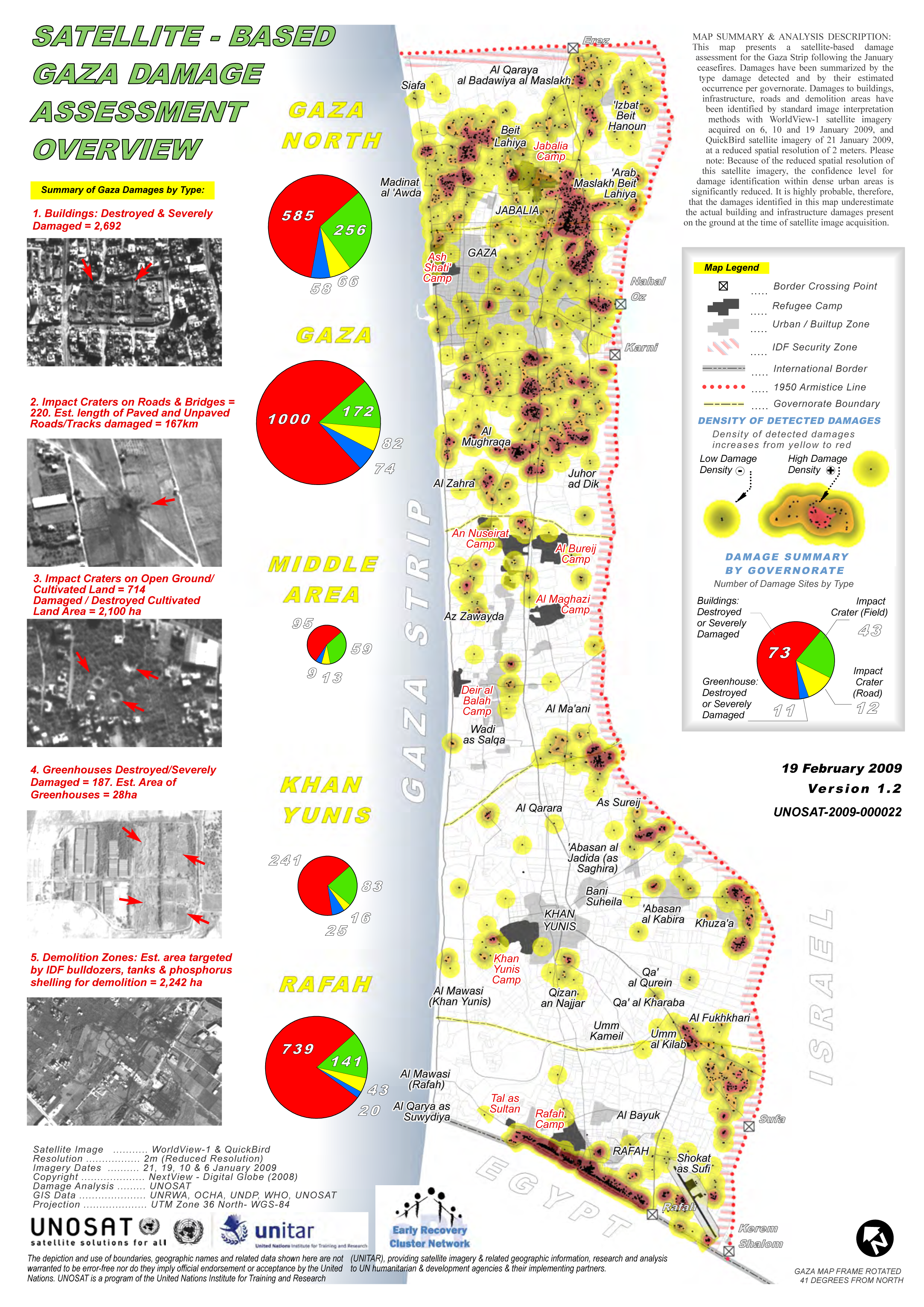
Description: From UNOSAT site http://unosat.web.cern.ch/unosat/ Satellite-Based Gaza Strip Damage Assessment Overview Product ID: 1338 - 10 Mar, 2009 - English This map presents a satellite-based damage assessment for the Gaza Strip following the January ceasefires. Damages have been summarized by the type damage detected and by their estimated occurrence per governorate. Damages to buildings, infrastructure, roads and demolition areas have been identified by standard image interpretation methods with WorldView-1 satellite imagery acquired on 6, 10 and 19 January 2009, and QuickBird satellite imagery of 21 January 2009, at a reduced spatial resolution of 2 meters. Please note: Because of the reduced spatial resolution of this satellite imagery, the confidence level for damage identification within dense urban areas is significantly reduced. It is highly probable, therefore, that the damages identified in this map underestimate the actual building and infrastructure damages present on the ground at the time of satellite image acquisition. Source(s): Satellite Image: WorldView-1 & QuickBird Resolution: 2m (Reduced Resolution) Imagery Dates: 21, 19, 10 & 6 January 2009 Copyright: NextView - Digital Globe (2008) Damage Analysis: UNOSAT GIS Data: UNRWA, OCHA, UNDP, WHO, UNOSAT
Note: A test conversion from PDF to SVG using Inkscape produced errors. Arrows indicating bomb craters etc were handed as text but converted to F chars.
Usage Terms: Public domain
Image usage
The following page links to this image:
