
Image: USGS Kīlauea image-405
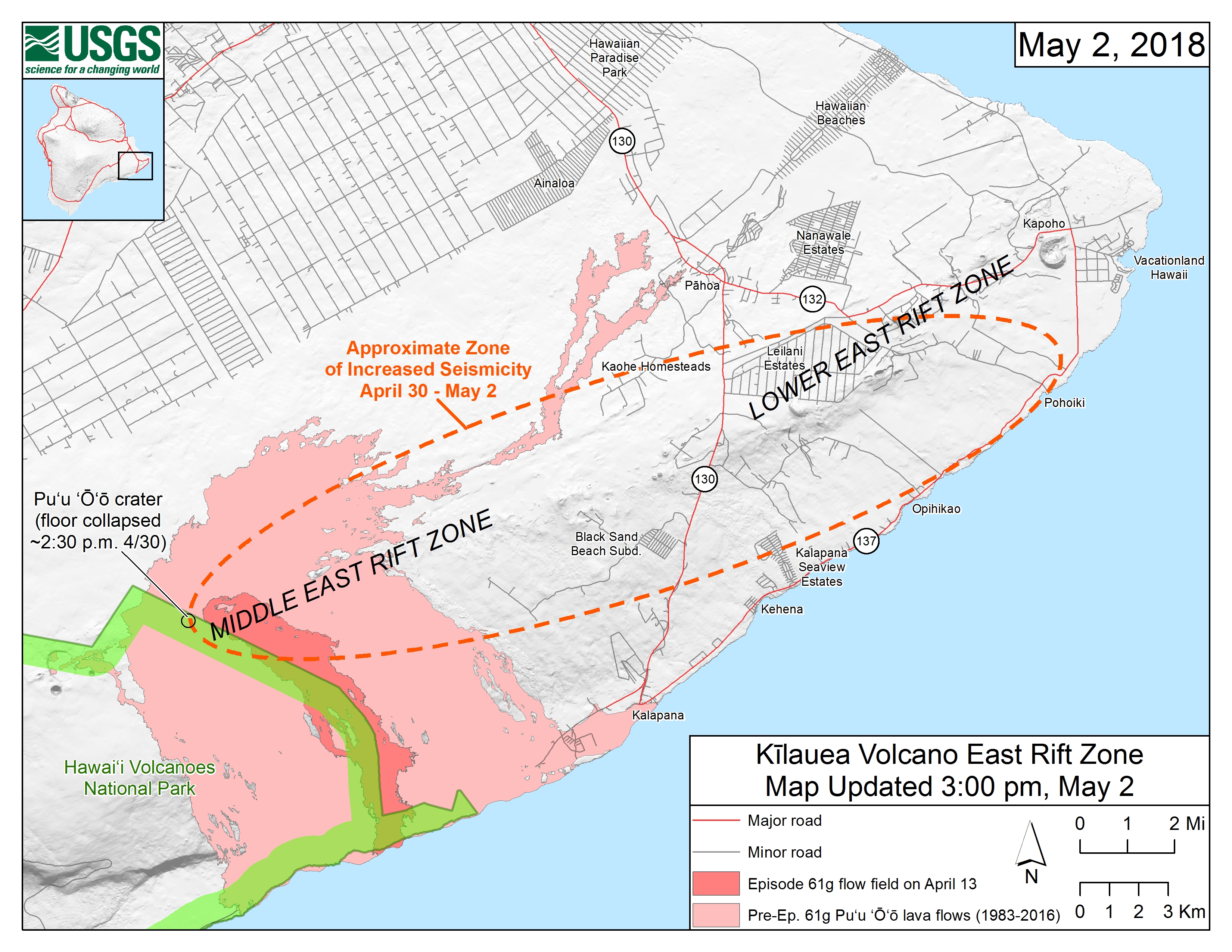
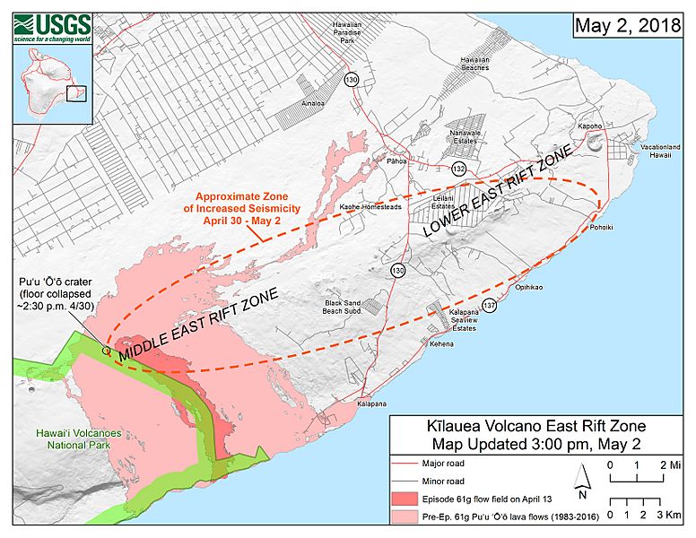
Description: Map of ongoing intrusion and earthquake activity along Kīlauea's East Rift Zone (May 2, 2018) Starting on the afternoon of Monday, April 30, 2018, magma beneath Pu‘u ‘Ō‘ō drained and triggered the collapse of the crater floor. Within hours, earthquakes began migrating east of Pu‘u ‘Ō‘ō, signaling an intrusion of magma along the middle and lower East Rift Zone. As of about noon on Wednesday, May 2, these earthquakes continue along the lower East Rift Zone, with many reports of earthquakes felt by residents in nearby subdivisions. The orange dashed line marks the approximate area within which most of the earthquakes are located based on automatic earthquake locations and analysis by seismologists. All earthquake locations are preliminary. For more details on the hazards associated with this ongoing event, see this link: https://volcanoes.usgs.gov/volcanoes/kilauea/status.html
Title: USGS Kīlauea image-405
Credit: https://volcanoes.usgs.gov/observatories/hvo/maps_uploads/image-405.jpg
Author: United States Geological Survey
Usage Terms: Public domain
License: Public domain
Attribution Required?: No
Image usage
The following 2 pages link to this image:
