
Image: USGS National Map viewer showing Kittanning Run, Pennsylvania location near Altoona--MIxed Mode topo+Sat

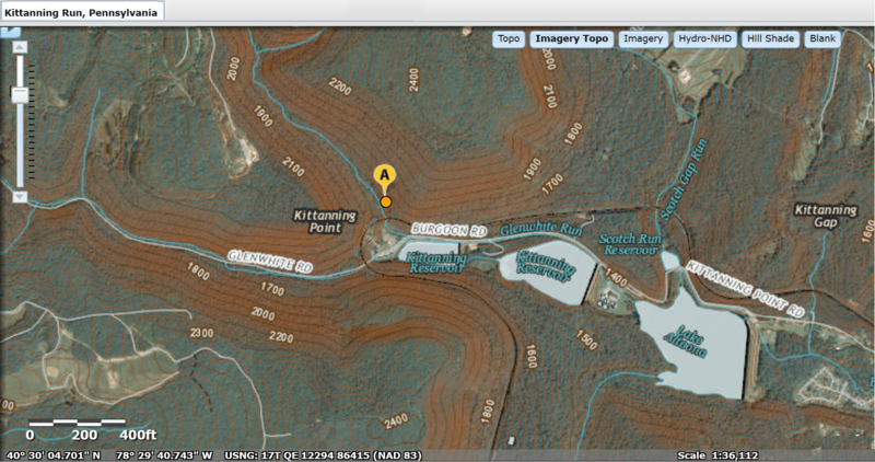
Description: --MIxed Mode View, topology and Satellite terrain USGS National Map viewer showing Kittanning Run, Pennsylvania—one creek among several creating the gaps in the Allegheny—that is in the Allegheny Front. -- The bubble location shown is along the westbound railroad between Altoona —the tunnels at under the drainage divides at Gallitzin & Tunnelhill.
Title: USGS National Map viewer showing Kittanning Run, Pennsylvania location near Altoona--MIxed Mode topo+Sat
Credit: This image is in the public domain in the United States because it only contains materials that originally came from the United States Geological Survey, an agency of the United States Department of the Interior. For more information, see the official USGS copyright policy. Български | Català | Čeština | Deutsch | English | Español | Eesti | فارسی | Suomi | Français | Galego | Italiano | 日本語 | 한국어 | Македонски | മലയാളം | Nederlands | Polski | Português | Русский | Sicilianu | Türkçe | 中文 | 中文(简体) | +/− http://viewer.nationalmap.gov/viewer
Author: Tweaks by FrankB
Usage Terms: Public domain
License: Public domain
Attribution Required?: No
Image usage
The following 4 pages link to this image:
