
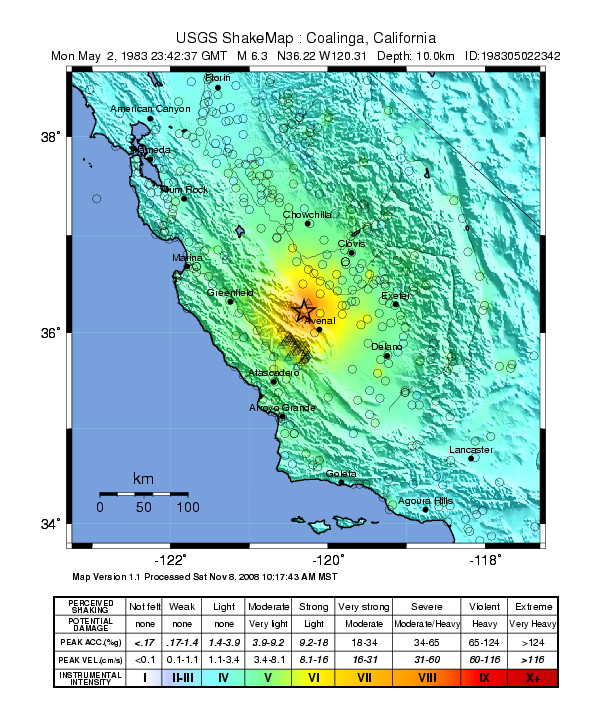
Image: USGS Shakemap - 1983 Coalinga earthquake (mainshock)
Size of this preview: 507 × 599 pixels. Other resolutions: 203 × 240 pixels | 612 × 723 pixels.
Original image (612 × 723 pixels, file size: 190 KB, MIME type: image/jpeg)
Description: USGS Shakemap for the mainshock of the 1983 Coalinga earthquake. Centered near Coalinga, in western Fresno County, central California.
Title: USGS Shakemap - 1983 Coalinga earthquake (mainshock)
Credit: [1]
Author: USGS
Usage Terms: Public domain
License: Public domain
Attribution Required?: No
Image usage
The following page links to this image:

All content from Kiddle encyclopedia articles (including the article images and facts) can be freely used under Attribution-ShareAlike license, unless stated otherwise.
.jpg)