
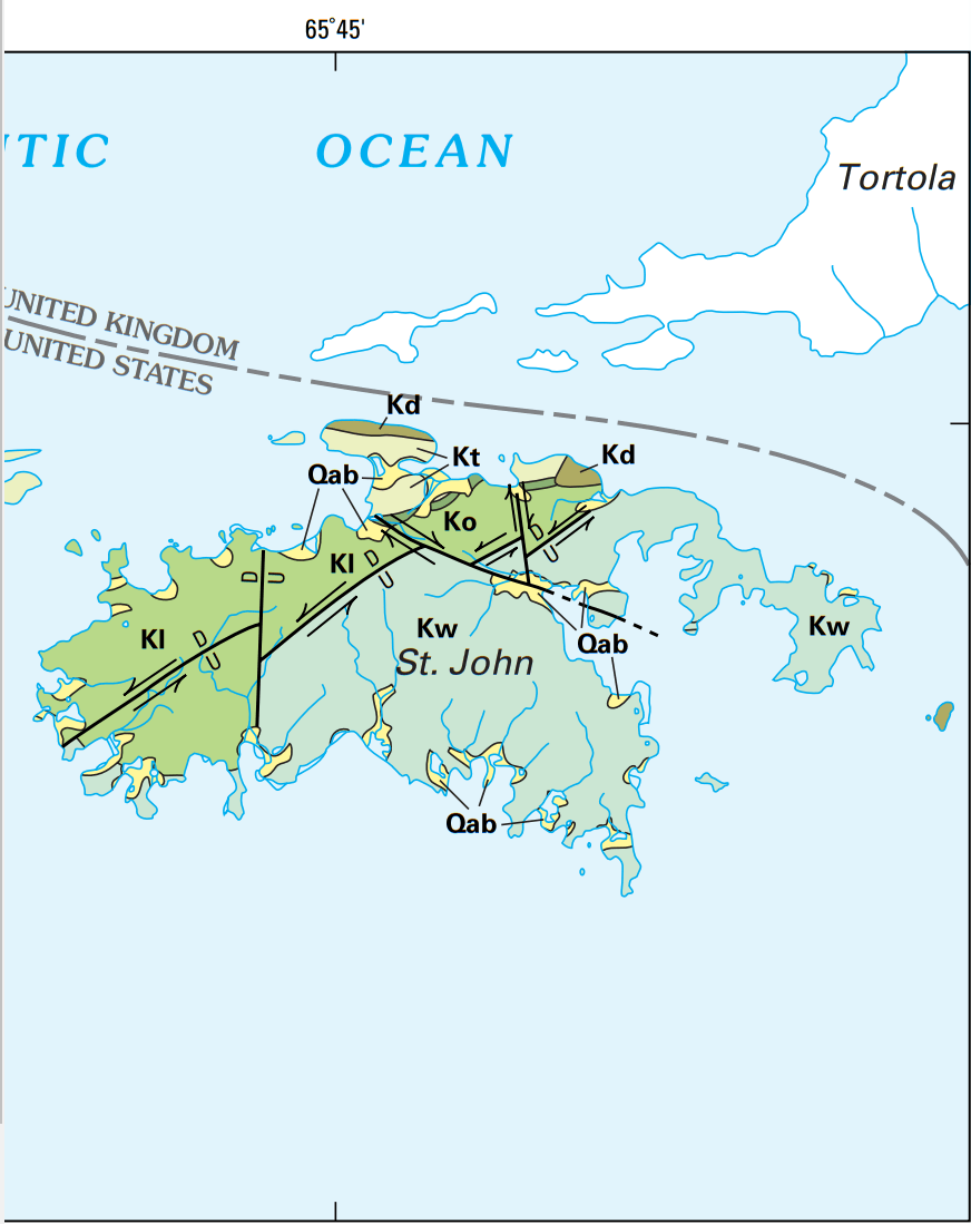
Image: USGS geologic map St John USVI
Description: USGS geologic map St John USVI, where Qab is Quaternary alluvium and minor beach deposits, Kt is the Cretaceous Tutu Formation, Ko is the Cretaceous Outer Brass Formation, Kl is the Cretaceous Lousenhoj Formation, Kw is the Water Island Formation, and Kd are Cretaceous dioritic rocks, while U and D show the upthrown and downthrown portion of faults.
Title: USGS geologic map St John USVI
Credit: Geology and Hydrogeology of the Caribbean Islands Aquifer System of the Commonwealth of Puerto Rico and the U.S. Virgin Islands, USGS Professional Paper 1419, https://pubs.usgs.gov/pp/pp1419/pdf/BOOK.PDF
Author: ROBERT A. RENKEN, W.C. WARD, I.P. GILL, FERNANDO GÓMEZ-GÓMEZ, JESÚS RODRÍGUEZ-MARTÍNEZ
Usage Terms: Public domain
License: Public domain
Attribution Required?: No
Image usage
The following page links to this image:
