
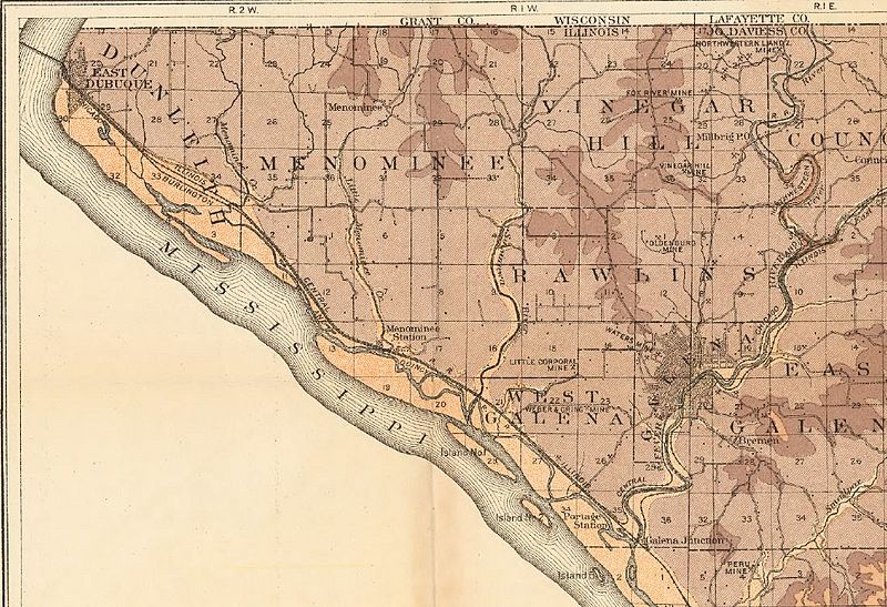
Image: USGS map of Galena mines

Size of this preview: 800 × 547 pixels. Other resolutions: 320 × 219 pixels | 1,099 × 751 pixels.
Original image (1,099 × 751 pixels, file size: 247 KB, MIME type: image/jpeg)
Description: USGS map of Galena mines, with the Ordovician Galena limestone denoted in light brown.
Title: USGS map of Galena mines
Credit: Zinc and lead deposits of northwestern Illinois, USGS Bulletin 246, https://pubs.er.usgs.gov/publication/b246
Author: Harry Foster Bain
Usage Terms: Public domain
License: Public domain
Attribution Required?: No
Image usage
The following page links to this image:

All content from Kiddle encyclopedia articles (including the article images and facts) can be freely used under Attribution-ShareAlike license, unless stated otherwise.