
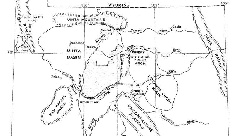
Image: Uinta Basin map

Size of this preview: 800 × 460 pixels. Other resolutions: 320 × 184 pixels | 976 × 561 pixels.
Original image (976 × 561 pixels, file size: 77 KB, MIME type: image/png)
Description: Uinta Basin map
Title: Uinta Basin map
Credit: Geology and Fuel Resources of the Green River Formation Southeastern Uinta Basin Utah and Colorado, USGS Professional Paper 548
Author: W.B. Cashion
Usage Terms: Public domain
License: Public domain
Attribution Required?: No
Image usage
The following page links to this image:

All content from Kiddle encyclopedia articles (including the article images and facts) can be freely used under Attribution-ShareAlike license, unless stated otherwise.