
Image: Un-mali Kayes Region
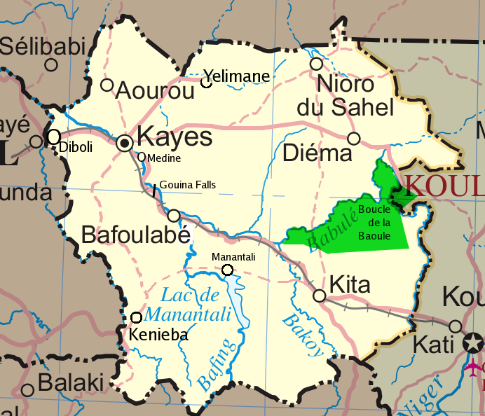
Description: Map of the Kayes Region of Mali. Additions include new northern road via Diema, several towns, downgrade of road (in fact unpaved) from Kayes to Kenieba. Solid pink lines are paved, dashed are unpaved. Addition of National park of Boucle du Baoule. Ref: Ross Velton. Mali. Bradt UK and Globe Pequot US (2005/2006) ISBN 9781841620770 Made with GIMP
Title: Un-mali Kayes Region
Credit: self-made, edit, crop, recolored, several additions to Image:Un-mali.png from http://www.un.org/Depts/Cartographic/english/htmain.htm
Author: T L Miles
Permission: Modified versions of UNCS maps may be used provided that the UN name and reference number does not appear on any modified version and a link to the original map is provided. Modified UN maps are to be considered in the public domain. This applies worldwide SEE: This image is a map derived from a United Nations map. Unless stated otherwise, UN maps are to be considered in the public domain. This applies worldwide. Some UN maps have special copyrights, as indicated on the map itself. UN maps are, in principle, open source material and you can use them in your work or for making your own map. UN requests however that you delete the UN name, logo and reference number upon any modification to the map. Content of your map will be your responsibility. You can state in your publication, if you wish, something like: based on UN map … (map name, map number, revision number and date). See: The UN Cartographic Section (retrieved 16 November 2013)
Usage Terms: Public domain
License: Public domain
Attribution Required?: No
Image usage
The following page links to this image:
