
Image: United States 1821-07-1821-08
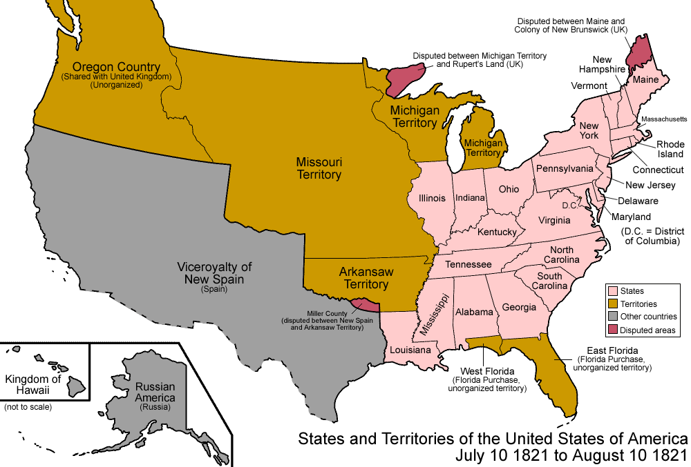
Description: Map of the states and territories of the United States as it was from July 1821 to August 1821. On July 10 1821, the Treaty of 1819 enters in to effect, settling all disputes with the Spanish colonies; the borders were defined in the west, and both Floridas were ceded to the United States, having been purchased as part of the treaty; a minor conflict was created with Arkansaw Territory's Miller County. On August 10 1821, part of Missouri Territory was admitted as the state of Missouri; the rest became unorganized.
Title: United States 1821-07-1821-08
Credit: Own work
Author: Made by User:Golbez.
Permission: Own work, attribution required (Multi-license with GFDL and Creative Commons CC-BY 2.5)
Usage Terms: Creative Commons Attribution 2.5
License: CC BY 2.5
License Link: http://creativecommons.org/licenses/by/2.5
Attribution Required?: Yes
Image usage
The following 10 pages link to this image:
- Adams–Onís Treaty
- List of territorial claims and designations in Colorado
- Outline of Oregon territorial evolution
- Outline of Wyoming territorial evolution
- Territorial evolution of Arizona
- Territorial evolution of California
- Territorial evolution of Idaho
- Territorial evolution of Nevada
- Territorial evolution of New Mexico
- Territorial evolution of Utah
