
Image: United States 1822-1824
Size of this preview: 800 × 542 pixels. Other resolutions: 320 × 217 pixels | 1,000 × 677 pixels.
Original image (1,000 × 677 pixels, file size: 104 KB, MIME type: image/png)
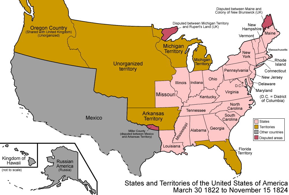
Description: Map of the states and territories of the United States as it was from 1822 to 1824. On March 30 1822, the two Floridas were organized as Florida Territory. On November 15 1824, Arkansas Territory shrank, the western portion becoming unorganized.
Title: United States 1822-1824
Credit: Own work
Author: Made by User:Golbez.
Permission: Own work, attribution required (Multi-license with GFDL and Creative Commons CC-BY 2.5)
Usage Terms: Creative Commons Attribution 2.5
License: CC BY 2.5
License Link: http://creativecommons.org/licenses/by/2.5
Attribution Required?: Yes
Image usage
The following 2 pages link to this image:

All content from Kiddle encyclopedia articles (including the article images and facts) can be freely used under Attribution-ShareAlike license, unless stated otherwise.