
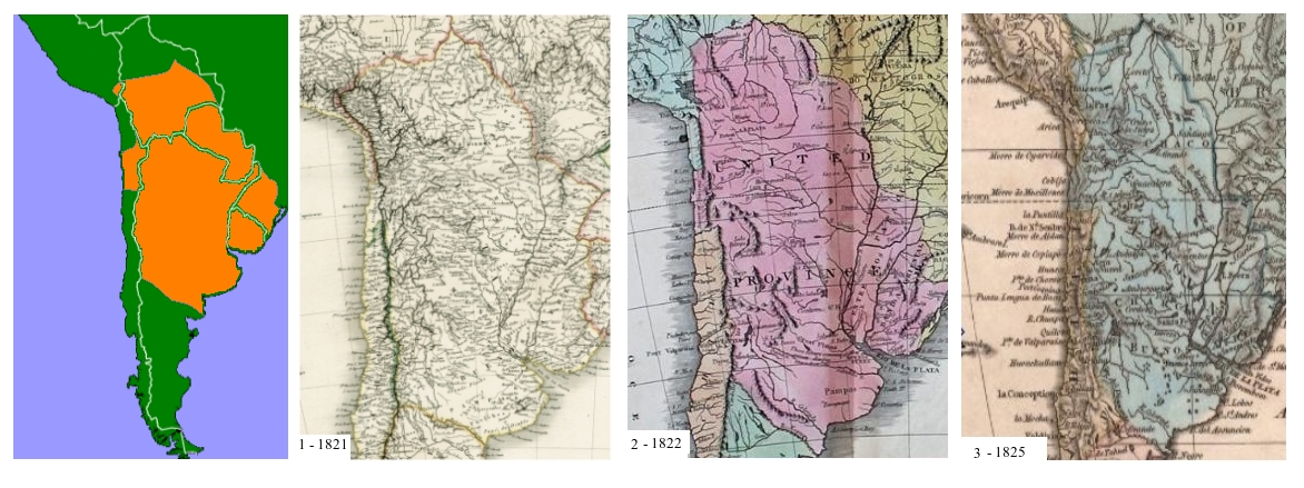
Image: Unitedprovincescirca1820
Size of this preview: 800 × 300 pixels. Other resolutions: 320 × 120 pixels | 1,172 × 439 pixels.
Original image (1,172 × 439 pixels, file size: 396 KB, MIME type: image/jpeg)
Description: The United Provinces of Rio de la Plata at its greatest extent as portrayed by cartographers of the time. (Now called Argentina)
Title: Unitedprovincescirca1820
Credit: 1 1821: Carte de Physique et Politique de L'Amerique Meridional. 2 1822: The American Atlas by Carey & Lea. 3 1825: South America by Fisher.
Author: 2. Carey & Lea, 3. Fisher
Usage Terms: Public domain
License: Public domain
Attribution Required?: No
Image usage
The following page links to this image:

All content from Kiddle encyclopedia articles (including the article images and facts) can be freely used under Attribution-ShareAlike license, unless stated otherwise.