
Image: UpperDiamantinaCrustalAnomaly
Size of this preview: 800 × 497 pixels. Other resolutions: 320 × 199 pixels | 858 × 533 pixels.
Original image (858 × 533 pixels, file size: 66 KB, MIME type: image/png)
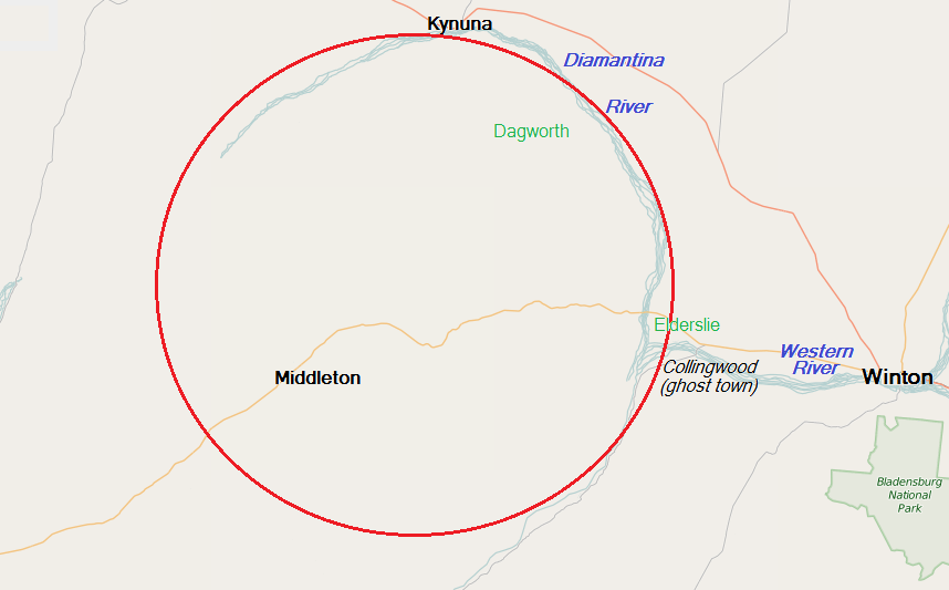
Description: Map of the region west of Winton, Queensland, Australia, in the headwaters of the Diamantina River, that is the subject of geological interest as a possible 300,000,000-year-old impact structure; places marked in green are pastoral stations.
Title: UpperDiamantinaCrustalAnomaly
Credit: OpenStreetMap Foundation
Author: © OpenStreetMap contributors, with uploader's modifications
Usage Terms: Creative Commons Attribution-Share Alike 4.0
License: CC BY-SA 4.0
License Link: http://creativecommons.org/licenses/by-sa/4.0
Attribution Required?: Yes
Image usage
The following 2 pages link to this image:

All content from Kiddle encyclopedia articles (including the article images and facts) can be freely used under Attribution-ShareAlike license, unless stated otherwise.