
Image: Upper Mississippi 1812
Size of this preview: 463 × 599 pixels. Other resolutions: 185 × 240 pixels | 816 × 1,056 pixels.
Original image (816 × 1,056 pixels, file size: 68 KB, MIME type: image/png)
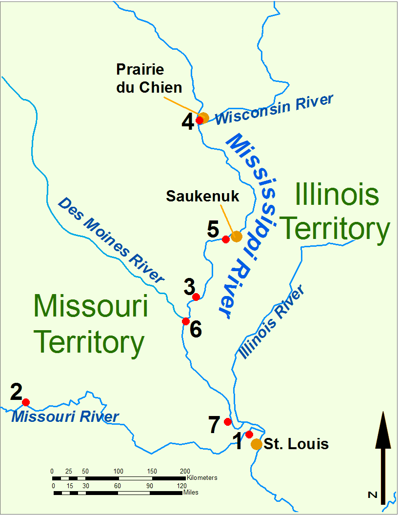
Description: Map of the upper Mississippi River during the War of 1812 Key: 1: Fort Bellefontaine U.S. headquarters 2: Fort Osage, abandoned 1813 3: Fort Madison, defeated 1813 4: Fort Shelby, defeated 1814 5: Battle of Rock Island Rapids, July 1814 and the Battle of Credit Island, Sept. 1814 6: Fort Johnson, abandoned 1814 7: Fort Cap au Gris and the Battle of the Sink Hole, May 1815.
Title: Upper Mississippi 1812
Credit: Own work (Original caption: “I (Bill Whittaker) created this work entirely by myself.”)
Author: Bill Whittaker (Billwhittaker at en.wikipedia)
Usage Terms: Creative Commons Attribution-Share Alike 3.0
License: CC BY-SA 3.0
License Link: http://creativecommons.org/licenses/by-sa/3.0
Attribution Required?: Yes
Image usage

All content from Kiddle encyclopedia articles (including the article images and facts) can be freely used under Attribution-ShareAlike license, unless stated otherwise.