
Image: UsedomWolin
No higher resolution available.
UsedomWolin.png (543 × 419 pixels, file size: 12 KB, MIME type: image/png)
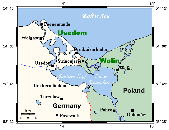
Description: A map of the islands of Usedom and Wolin and environs, Germany/Poland. This map's source is here, with the uploader's modifications, and the GMT homepage says that the tools are released under the GNU General Public License.
Title: UsedomWolin
Credit: Transferred from en.wikipedia to Commons.
Author: Kelisi at English Wikipedia
Usage Terms: GNU Free Documentation License
License: GFDL
License Link: http://www.gnu.org/copyleft/fdl.html
Attribution Required?: Yes
Image usage
The following 4 pages link to this image:

All content from Kiddle encyclopedia articles (including the article images and facts) can be freely used under Attribution-ShareAlike license, unless stated otherwise.