
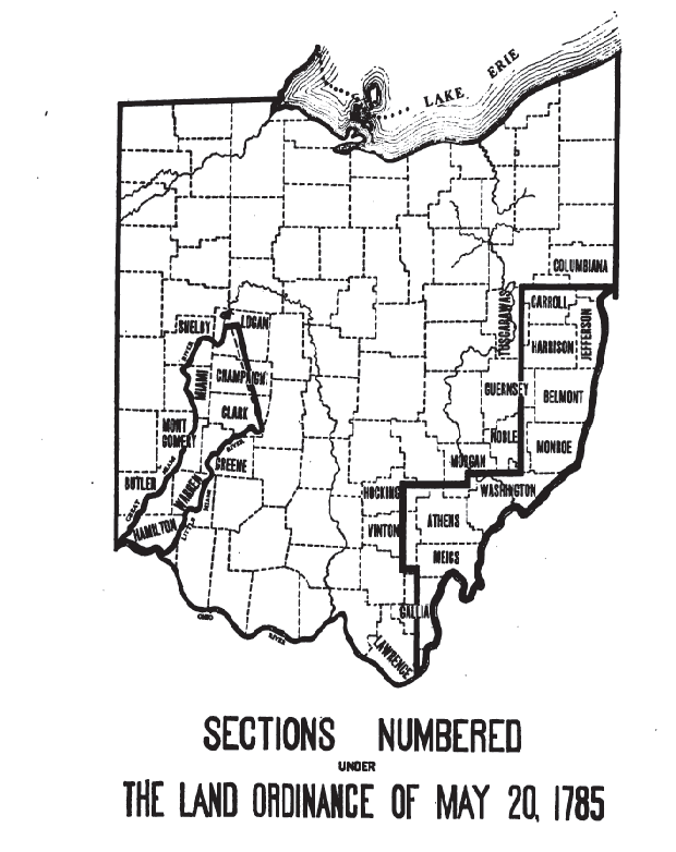
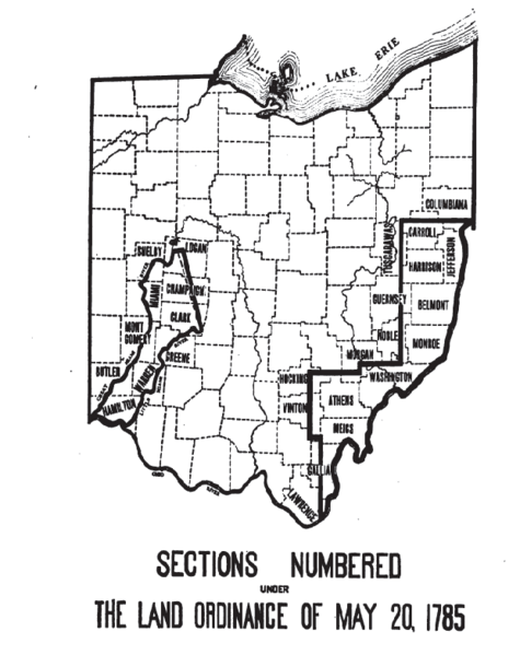
Image: Uses 1785 numbering
Size of this preview: 475 × 599 pixels. Other resolutions: 190 × 240 pixels | 620 × 782 pixels.
Original image (620 × 782 pixels, file size: 52 KB, MIME type: image/png)
Description: tracts in en:Ohio that were surveyed, all in the 18th century, into townships with individual sections numbered by the procedures of the en:Land Ordinance of 1785
Title: Uses 1785 numbering
Credit: Peters, William E. (1918) Ohio Lands and Their Subdivisions, W.E. Peters, pp. 308
Author: William E. Peters
Usage Terms: Public domain
License: Public domain
Attribution Required?: No
Image usage
The following page links to this image:

All content from Kiddle encyclopedia articles (including the article images and facts) can be freely used under Attribution-ShareAlike license, unless stated otherwise.