
Image: Verendrye-map
No higher resolution available.
Verendrye-map.gif (520 × 435 pixels, file size: 130 KB, MIME type: image/gif)
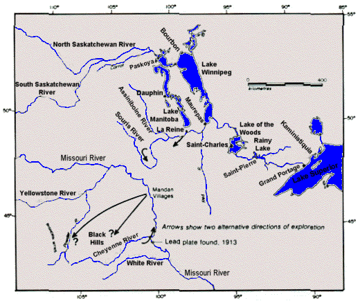
Description: A map showing the area of operations of the La Verendrye family in the 1730s and 1740s
Title: Verendrye-map
Credit: The Robinson Library
Author: http://www.robinsonlibrary.com/america/canada/northwest/verendrye.htm
Usage Terms: Creative Commons Zero, Public Domain Dedication
License: CC0
License Link: http://creativecommons.org/publicdomain/zero/1.0/deed.en
Attribution Required?: No
Image usage
The following 3 pages link to this image:

All content from Kiddle encyclopedia articles (including the article images and facts) can be freely used under Attribution-ShareAlike license, unless stated otherwise.