
Image: Vesuvius 79 AD eruption-la

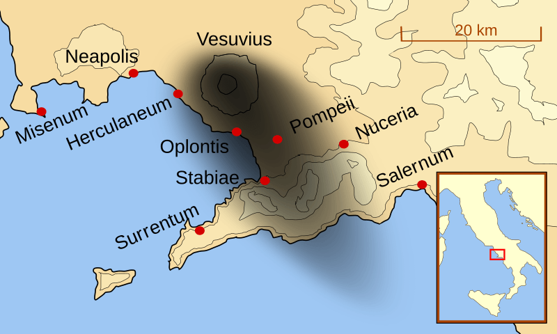
Description: A map showing the cities and towns(with their Latin names0 which were affected by the eruption of Mount Vesuvius in 79 AD. The general shape of the ash and cinder fall (see w:en:pyroclast) is shown by the dark area to the southeast of Mt Vesuvius. This map shows modern day coast lines and uses the Mercator projection (although that is not important on a map of this scale). North is, as usual, at the top of the map.
Title: Mt Vesuvius 79 AD eruption-la
Credit: Own work
Author: MapMaster
Usage Terms: Creative Commons Attribution-Share Alike 3.0
License: CC BY-SA 3.0
License Link: http://creativecommons.org/licenses/by-sa/3.0
Attribution Required?: Yes
Image usage
The following image is a duplicate of this image (more details):
The following page links to this image:
