
Image: Viceroyalty of New Granada (orthographic projection)

Size of this PNG preview of this SVG file: 550 × 550 pixels. Other resolution: 240 × 240 pixels.
Original image (SVG file, nominally 550 × 550 pixels, file size: 429 KB)
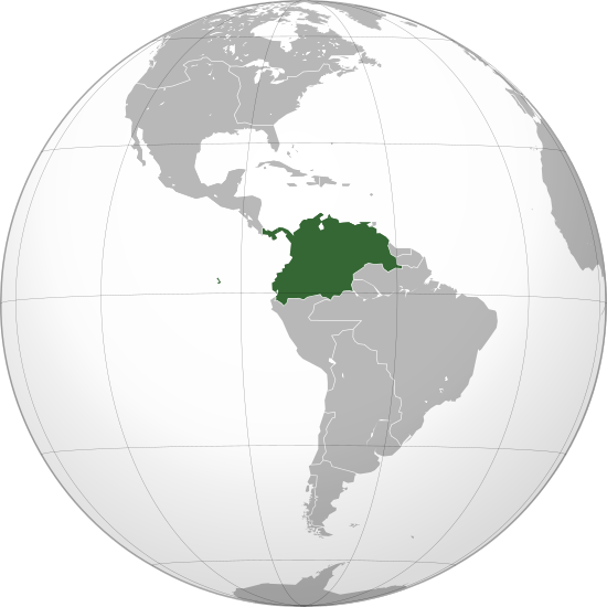
Description: Location of the Viceroyalty of New Granada in orthographic projection, approx. 1780.
Title: Viceroyalty of New Granada (orthographic projection)
Credit: Own work Boundaries based in the following sources: Guyanas, Brazil, La Plata, Patagonia: File:Mapa Geografico de America Meridional_(1790).jpg United States: File:United States 1798-1800-07-04.png New Spain: File:Reyno de la Nueva España (Siglo XIX).JPG New Granada: File:Nuevo Reino Granada.jpg, File:Mapa del Virreinato de Nueva Granada.png
Author: Milenioscuro
Usage Terms: Creative Commons Attribution-Share Alike 3.0
License: CC BY-SA 3.0
License Link: https://creativecommons.org/licenses/by-sa/3.0
Attribution Required?: Yes
Image usage
The following 2 pages link to this image:

All content from Kiddle encyclopedia articles (including the article images and facts) can be freely used under Attribution-ShareAlike license, unless stated otherwise.
.svg)