
Image: View of Beaverton 1950's (Beaverton, Oregon Historical Photo Gallery) (10)

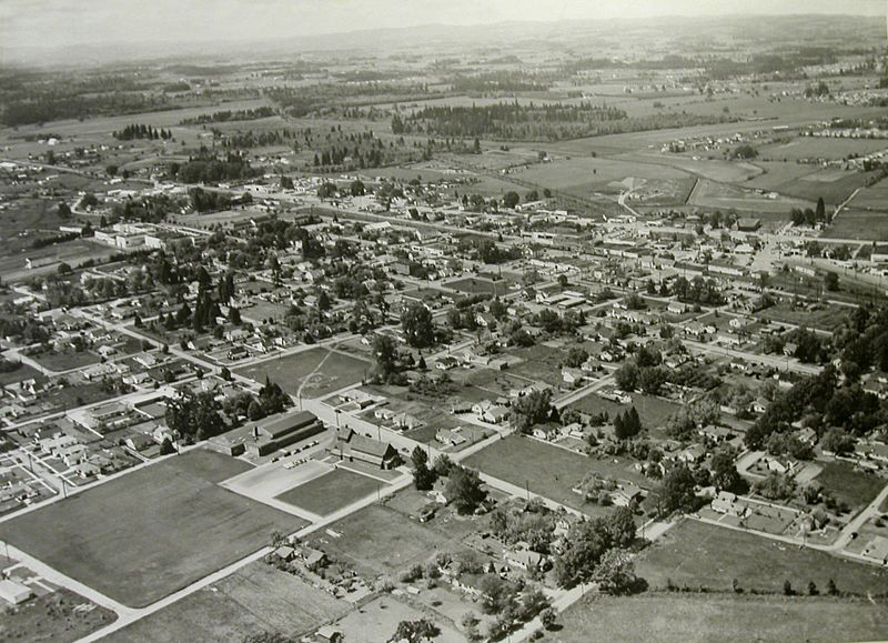
Description: View of Beaverton 1950's. Historical images of Beaverton, Oregon. This view is looking northwest (from approximately above 11th or 12th & Alger) towards downtown. St. Cecilia Catholic Church is visible at the north end of the large open lot in the lower left quandrant of the frame. The two north–south streets that go out of frame at the bottom of the photo are Franklin Street (left) and Lombard Street (now Lombard Avenue). The east-west arterial street in the upper part of the frame is Highway 8 (Canyon Road), with Highway 10 (Farmington Road) just below it and almost parallel. The large, light-colored building near the left end of the frame is Beaverton High School. The runways of the former Bernard's Airport can just be discerned in the upper right quandrant of the photo.
Title: View of Beaverton 1950's (Beaverton, Oregon Historical Photo Gallery) (10)
Credit: Beaverton Oregon Historical Photo Gallery: Aerial Gallery Direct
Author: Unknown photographer
Permission: This file is in the public domain because the city of Beaverton, Oregon is not aware of any copyrights asserted over these pictures. These photos originate from the Beaverton, Oregon Historical Photo Gallery. This template must not be used to dedicate an uploader's own work to the public domain; CC0 should be used instead. This work must carry justifications for free usability in both the United States and its country of origin.
Usage Terms: Public domain
License: Public domain
Attribution Required?: No
Image usage
The following page links to this image:

_(10).jpg)