
Image: Vue de Port-au-Prince et ses environs ca1800 BPL m8805
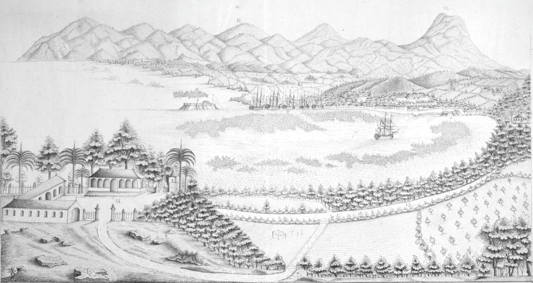
Description: Vue de Port-au-Prince et ses environs Date: ca.1800 Dimensions: 28.0 x 49.0 cm. DESCRIPTION: "This landscape view provides an elevated perspective of the harbor of Port-au-Prince, the capital city of Haiti. The view is from south to north, with the bulk of the developed town on the northern side of the harbor. In the background at the left is Fort Joseph, later known as Fort Dauphin or Fort Liberte. In the foreground is the palatial residence of the marine commissar, one Monsieur Mardssaux. The reference to this "Commissaire de la marine," a French military post, suggests that the image was created before Haiti's independence from France in 1804. The title and legend at the bottom of the image were added by hand, and include references to forts, "quarters," roads, and plazas in and around Port-au-Prince. Circa 1800."
Title: Vue de Port-au-Prince et ses environs ca1800 BPL m8805
Credit: Boston Public Library. http://maps.bpl.org/id/m8805
Author: Unknown authorUnknown author
Usage Terms: Public domain
License: Public domain
Attribution Required?: No
Image usage
The following page links to this image:
